TNTmips for Mac OS X 20240111
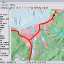
TNTmips is a geospatial image processing tool that allows you to analyze and modify GIS images. It is a professional application that can handle desktop cartography, electronic atlas preparation and spatial database management. ...
| Author | MicroImages, Inc. |
| License | Freeware |
| Price | FREE |
| Released | 2024-01-11 |
| Downloads | 244 |
| Filesize | 87.90 MB |
| Requirements | Mac (OS 10.8 to 11), XQuartz 2.7.9 needed (2.7.11 with manual modification) |
| Installation | Instal And Uninstall |
| Keywords | GIS data analysis, analyze geodetic data, edit GIS dataset, GIS, dataset, editor, analysis, mac os, TNTmips for mac, TNTgis for mac, TNTedit |
| Users' rating (45 rating) |
Using TNTmips for Mac OS X Free Download crack, warez, password, serial numbers, torrent, keygen, registration codes,
key generators is illegal and your business could subject you to lawsuits and leave your operating systems without patches.
We do not host any torrent files or links of TNTmips for Mac OS X on rapidshare.com, depositfiles.com, megaupload.com etc.
All TNTmips for Mac OS X download links are direct TNTmips for Mac OS X full download from publisher site or their selected mirrors.
Avoid: 3d images processing oem software, old version, warez, serial, torrent, TNTmips for Mac OS X keygen, crack.
Consider: TNTmips for Mac OS X full version, 3d images processing full download, premium download, licensed copy.


