Design Master HVAC 6

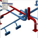
Design Master HVAC is an integrated HVAC building design and drafting program that runs on top of AutoCAD. Drafting features include single-line and double-line 2D ductwork with automatic fittings and 3D ductwork. Duct sizing calculations include constant pressure drop, constant velocity, and static regain. Pressure drop in the duct system can also be calculated. Building load calculations are done using the ASHRAE CLTD method. ...

Author Design Master Software, Inc.
License Commercial
Price $840.00
Released 2007-12-03
Downloads 658
Filesize 6.23 MB
Requirements AutoCAD 2004, 2005, 2006, 2007, 2008, or 2009
Installation Install and Uninstall
Keywords hvac software, duct design, duct sizing, static regain, duct drafting, 3d ductwork, hvac bim, hvac building information modeling
Users' rating
(1 rating)
Design Master HVACCADWindows XP, Windows 2000
Design Master HVAC 3d software - Download Notice

Using Design Master HVAC Free Download crack, warez, password, serial numbers, torrent, keygen, registration codes, key generators is illegal and your business could subject you to lawsuits and leave your operating systems without patches. We do not host any torrent files or links of Design Master HVAC on rapidshare.com, depositfiles.com, megaupload.com etc. All Design Master HVAC download links are direct Design Master HVAC full download from publisher site or their selected mirrors.
Avoid: 3d software oem software, old version, warez, serial, torrent, Design Master HVAC keygen, crack.
Consider: Design Master HVAC full version, 3d software full download, premium download, licensed copy.

Design Master HVAC 3d software - The Latest User Reviews

Most popular CAD downloads

RISA-3D

22.0 download

... RISA-3D. Easily the most popular general 3D analysis/design software available, our intuitive interface and familiar spreadsheets help ... with advanced analysis capabilities make this industry standard software a very powerful tool for the analysis and ...

Automesher 64-bit

2.4.8 download

Automesher x64 application extends AutoCAD and BricsCAD software with functionality to import and export 3D file formats and convert 3D drawing entity types. It supports many of 3D file extensions, ...

AutoCAD 2020

2025 download

AutoCAD remains one of the top applications used by professionals to achieve great precision with projects of nearly any type. It encourages usage with incredible offers for student licenses so you ...

JohanneumSTM

20120512 Beta download

... tool for 2D and 3D STM viewing. This software is designed for DAQ systems by BMCM (we use the USB-AD16F), but it should not be too difficult to adapt it ...

Gmsh

4.13.1 download

... visualization capabilities. Gmsh is a portable piece of software which features a built-in CAD engine and post-processing ... for advanced users. Gmsh is a CAD software that helps you to design 3D elements. The ...

Gmsh for Linux

4.13.1 download

... advanced visualization capabilities. Gmsh is a CAD software that helps you to design 3D elements. Gmsh is built around four modules: geometry, mesh, solver and post-processing. The specification ...

jHepWork

3.28.2 download

... and students. The program incorporates many open-source math software packages into a coherent interface using the concept ... visualization which have no analogy in other data-analysis software. Programs written using the jHepWork framework are very ...

5 award

SCARM

1.9.5 download

SCARM is freeware program for simplified design of scaled railway model layouts and modelling of miniature model track routes. It has lightweight and intuitive user interface, 3D view and many other ...

5 award

Model Air Design

2.4 download

Model Aircraft Design software for Windows PC. Model Air Design is the ... way to create airplane models. It's a modern software tool for model aircraft design. Model Air Design ... models but have found Computer Aided Design (CAD) software too difficult and time-consuming to learn. We have ...

TNTmips

20240404 download

TNTmips software is a complete Geographic Information System (GIS) that lets you work with virtually any type of geospatial data including imagery, terrain surfaces, and map data with associated database ...