FlashPoints 3.0

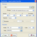
FlashPoints is a tool for creating and managing points Groups (topographic points for example). FlashPoints allows you to : * import/export points coordinates from and to a file * create points and their attributes 'Number', 'Elevation' and 'Description' by clicking * modify the points elevation * modify the height and rotation of the attributes * create points on existing entities * create the table of the coor ...

Author DeliCAD
License Demo
Price $70.00
Released 2016-02-18
Downloads 105
Filesize 3.94 MB
Requirements
Installation Install and Uninstall
Keywords autocad, cad, dxf, xls, excel, gps, xyz, nxyz, points, import, cogo, survey, coordinates, gis, topography
Users' rating
(2 rating)
FlashPointsCADWin2000, Windows XP, Windows 7 x32, Windows 7 x64, Windows 8, Windows 10, WinServer, WinOther, Windows Vista, Windows Vista x64
FlashPoints cad to gis - Download Notice

Using FlashPoints Free Download crack, warez, password, serial numbers, torrent, keygen, registration codes, key generators is illegal and your business could subject you to lawsuits and leave your operating systems without patches. We do not host any torrent files or links of FlashPoints on rapidshare.com, depositfiles.com, megaupload.com etc. All FlashPoints download links are direct FlashPoints full download from publisher site or their selected mirrors.
Avoid: cad to gis oem software, old version, warez, serial, torrent, FlashPoints keygen, crack.
Consider: FlashPoints full version, cad to gis full download, premium download, licensed copy.

FlashPoints cad to gis - The Latest User Reviews

Most popular CAD downloads

TNTmips

20240404 download

... Spatial, DGN, TAB, DXF, DWG ... Full-featured GIS that integrates imagery along with geometric data including vector, CAD, shape, pinmap, and TIN formats. Maintain relational database attributes for vector, CAD, and shape layers ... The Job Processing ...

IrriPro

3.1 download

... as objects containing hydraulic characteristics, geometries, materials and GIS informations obtained by Google Earth. Thanks to IrriPro's ... efficiently any kind of system. IrriPro has a CAD-style user friendly interface, designed to be used by ...

FlashPoints

3.0 download

FlashPoints is a tool for creating and managing points Groups (topographic points for example). FlashPoints allows you to : * import/export points coordinates from and to a file * create points ...

TNTmips for Mac OS X

20240111 download

... Oracle Spatial, DGN, TAB, DXF, DWG. Full-featured GIS that integrates imagery along with geometric data including vector, CAD, shape, pinmap, and TIN formats. Maintain relational database attributes for vector, CAD, and shape layers. The Job Processing system ...

WindRose PRO

3.1.54.0 download

... BMP format or exported in DXF format for CAD environments, as shapefiles for GIS environments and as KML files for Google Earth. ... others) Exports wind rose plots as DXF for CAD environments Exports wind rose plots as SHP (ESRI ...

Virtual Terrain Project for Windows

1.1 110804 download

... require a synergetic convergence of the fields of CAD, GIS, visual simulation, surveying and remote sensing. VTP gathers ...

Virtual Terrain Project for Mac OS X and Linux

1.1 110804 download

... require a synergetic convergence of the fields of CAD, GIS, visual simulation, surveying and remote sensing. VTP gathers ...

Autodesk Infrastructure Design Suite

2016 download

3D design tools for civil engineering Use the intelligent, model-based tools in Infrastructure Design Suite to gain more accurate, accessible, and actionble insight throughout the lifecycle of your civil engineering ...