HatchKit 2.7.1.1996

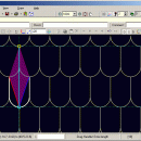
Draw a pattern from scratch, open an existing pattern file or import DXF. Paste Windows Clipboard. Add or delete elements. Zoom/pan. Arrange repeats along any two axes. Snap to optional grid. Object Snap. Form multi-spaced patterns. Rescale. Transform. Customize. Save to ArchiCAD, AutoCAD, Alibre, AllyCAD, DataCAD, DXF, General CADD, IntelliCAD, MegaCAD, MicroStationV8, Revit, Rhino, SolidWorks, Spirit, TurboCAD, VectorWorks, VersaCAD VisualCADD. ...

Author Cadro Pty Ltd
License Demo
Price $125.00
Released 2008-03-27
Downloads 2095
Filesize 852 kB
Requirements at least 800x600 color display, mouse
Installation Install and Uninstall
Keywords hatch, pattern, editor, create, generator, cad, autocad, ArchiCAD, Alibre, AllyCAD, Chief Architect, DataCAD, Revit, IntelliCAD, MegaCAD, MicroStation, Rhino, Spirit, SolidWorks, TurboCAD, VectorWorks, uscs, iso 710, engineering, cartography, architecture, design, drafting
Users' rating
(14 rating)
HatchKitCADWindows 2000, Windows XP, Windows 2003
HatchKit cartography - Download Notice

Using HatchKit Free Download crack, warez, password, serial numbers, torrent, keygen, registration codes, key generators is illegal and your business could subject you to lawsuits and leave your operating systems without patches. We do not host any torrent files or links of HatchKit on rapidshare.com, depositfiles.com, megaupload.com etc. All HatchKit download links are direct HatchKit full download from publisher site or their selected mirrors.
Avoid: cartography oem software, old version, warez, serial, torrent, HatchKit keygen, crack.
Consider: HatchKit full version, cartography full download, premium download, licensed copy.

HatchKit cartography - The Latest User Reviews

Most popular CAD downloads

2D DXF DWG CGM SVG HPGL Import DLL

9 download

... sectors, such as mechanical engineering, building, circuit technology, cartography and analytic systems, where it is necessary to work with CAD file formats such as AutoCAD DWG, DXF, DWF, Hewlett-Packard HPGL, ...

HatchKit

2.7.1.1996 download

HatchKit v2.7 CAD Visual CAD Hatch Pattern Editor HatchKit provides a complete visual solution to your custom hatch pattern creation and modification requirements. . HatchKit supports ArchiCAD, AutoCAD, ACADLT, ADT, Alibre, ...

Screen Protractor

4.0 download

... to measure onscreen in degrees and radians. - Cartography: measure bearings and overlay any mapping software or images. - Microscopy: measure tiny biological forms. - Criminology: accurately detect angles from ...

Screen Protractor Mac Edition

3.2 download

... to measure onscreen in degrees and radians. - Cartography: measure bearings and overlay any mapping software or images. - Microscopy: measure tiny biological forms. - Criminology: accurately detect angles from ...

Gephi

0.10.1 download

... file format · Graph streaming ready Create cartography: · Use ranking or partition data to make meaningful the network representation. Customize colors, size or labels to bring sense to ...

Gephi for Linux

0.10.1 download

... file format · Graph streaming ready Create cartography: · Use ranking or partition data to make meaningful the network representation. Customize colors, size or labels to bring sense to ...

Gephi for Mac OS X

0.10.1 download

... file format · Graph streaming ready Create cartography: · Use ranking or partition data to make meaningful the network representation. Customize colors, size or labels to bring sense to ...

FONZIE

12.2010 download

FONZIE was designed to successively 1) perform a search for markers via the external software Tandem Repeat Finder, 2) exclude user-defined specific genomic regions, 3) screen for the size and the ...

TNTmips

20240404 download

TNTmips software is a complete Geographic Information System (GIS) that lets you work with virtually any type of geospatial data including imagery, terrain surfaces, and map data with associated database attributes. ...

TNTmips for Mac OS X

20240111 download

TNTmips for Mac is a complete Geographic Information System (GIS) that lets you work with virtually any type of geospatial data including imagery, terrain surfaces, and map data with associated database ...