SimplyCam 3.66

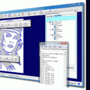
... create, edit and save drawings in industry standard DXF format. Also convert raster images (Bmp and Jpeg) to vector. Generate the contour/engraving, drill and pocket toolpaths for Cnc machines. Import NC programs and simulate it. Included great number of open post-processor such as: AutoGrav, Fanuc, Fadal, Haas, Heidehain, Iso, Mach2/3, MaxNc, Siemens, ShopBot, Tecno-Isel, TurboCnc.. ...

Author MR Soft
License Free To Try
Price $70.00
Released 2020-01-24
Downloads 1570
Filesize 1.63 MB
Requirements Pentium/Amd >300 MHz, True color Video Card (24-bit) - 800 x 600
Installation Install and Uninstall
Keywords cnc, r2v, photo, engraving, bmp, hobby, carving, mill, cad, cam, stl, image, dxf, svg, raster, grayscale, conversion, g-code
Users' rating
(30 rating)
SimplyCamCADWin2000, Windows 7 x32, Windows Vista, Windows XP
SimplyCam convert dxf - Download Notice

Using SimplyCam Free Download crack, warez, password, serial numbers, torrent, keygen, registration codes, key generators is illegal and your business could subject you to lawsuits and leave your operating systems without patches. We do not host any torrent files or links of SimplyCam on rapidshare.com, depositfiles.com, megaupload.com etc. All SimplyCam download links are direct SimplyCam full download from publisher site or their selected mirrors.
Avoid: convert dxf oem software, old version, warez, serial, torrent, SimplyCam keygen, crack.
Consider: SimplyCam full version, convert dxf full download, premium download, licensed copy.

SimplyCam convert dxf - The Latest User Reviews

Most popular CAD downloads

R2V

3.66 download

R2V is a tool for converting raster images to vector by drawing centerlines and outlines. R2V converts architect, mechanical and various technical drawings, maps and ... The output vector file can be saved in DXF (Autocad), HGL (HPGL) and TXT (ASCII XY) format. ...

PDF to DWG Converter (Developer License)

2.0 download

VeryDOC PDF to DWG Converter can be used to batch convert PDF files to DWG or DXF files, it is a stand-alone program that needn't ... etc. versions. This powerful program will help you convert your PDF files to usable and editable DWG ...

GstarCAD MC

3.3.1 download

... and edit CAD drawings ( DWG, OCF and DXF files) directly on your mobile device after transferring ... kinds of situation, and fully compatible with DWG, DXF. Various of CAD features such as: Edit, View, ...

Gerbview x64

10.21 download

... to use Gerber viewer. View, markup, print and convert your Gerber, Excellon and HPGL files. Create layered PDF, DXF and DWF files from your Gerber files. Convert to TIFF, CALS and other formats. GerbView x64 ...

TNTmips

20240404 download

... number of raster, geometric, and database file formats; convert between data types; and link to relational databases. ... ECW, shapefile, File Geodatabase, Oracle Spatial, DGN, TAB, DXF, DWG ... Full-featured GIS that integrates imagery ...

DWG DXF to Images Converter

2.1 download

Batch convert DWG and DXF to JPG, TIFF, BMP, GIF, PNG, SVG, CGM, WMF and EMF without Autocad! DWG DXF to Images Converter is a batch converter that allows you to ...

DWG FastView Plus

1.0 download

... tools like linear, align, angular and much more. Convert one or a bunch of selected drawing files ... applied to measurement and dimensioning only. Ability to Convert a bunch of DWG files to an older ...

VeryUtils DWG to Image Converter Command Line

2.7 download

VeryUtils DWG to Image Converter Command Line can be used to batch convert DWG and DXF files to TIF (TIFF), JPG (JPEG), BMP, GIF, ... without the need of AutoCAD. Allows you to convert your drawings into image files easily without purchasing ...

VeryUtils DWG to PDF Converter Command Line

2.7 download

VeryUtils AutoCAD DWG to PDF Converter Command Line is a DWG and DXF to PDF conversion tool, you can use it to convert DWG to PDF and DXF to PDF directly ...

TNTmips for Mac OS X

20240111 download

... number of raster, geometric, and database file formats; convert between data types; and link to relational databases. ... ECW, shapefile, File Geodatabase, Oracle Spatial, DGN, TAB, DXF, DWG. Full-featured GIS that integrates imagery along ...