CST CAD Navigator 1

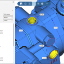
... convert different 2D/3D files, get their dimensions and create section views. CST CAD Navigator supports AutoCAD DWG, DXF, PLT, SVG, CGM, STEP, IGES, STL, SLDPRT, X_T, X_B, and other formats. The software is compatible with Windows, macOS, and Linux. ...

Author CADSoftTools
License Free To Try
Price $79.00
Released 2021-02-25
Downloads 69
Filesize 19.87 MB
Requirements Processor: 2.6 GHz, Display Card: OpenGL 4.0 compliant, Memory: 4 GB, System: Windows 7/8/8.1/10
Installation Install and Uninstall
Keywords CAD, CAD software, CAD viewer, 3D viewer, DWG, DXF, STEP, IGES, STL, SLDPRT, X_T, X_B, measuring tools, CAD converter, DWG viewer, STEP viewer, IGES viewer, SLDPRT viewer, X_T viewer
Users' rating
(13 rating)
CST CAD NavigatorCADWin2000, Windows XP, Windows 7 x32, Windows 7 x64, Windows 8, Windows 10, WinServer, WinOther, Windows Vista, Windows Vista x64
CST CAD Navigator create 3d - Download Notice

Using CST CAD Navigator Free Download crack, warez, password, serial numbers, torrent, keygen, registration codes, key generators is illegal and your business could subject you to lawsuits and leave your operating systems without patches. We do not host any torrent files or links of CST CAD Navigator on rapidshare.com, depositfiles.com, megaupload.com etc. All CST CAD Navigator download links are direct CST CAD Navigator full download from publisher site or their selected mirrors.
Avoid: create 3d oem software, old version, warez, serial, torrent, CST CAD Navigator keygen, crack.
Consider: CST CAD Navigator full version, create 3d full download, premium download, licensed copy.

CST CAD Navigator create 3d - The Latest User Reviews

Most popular CAD downloads

SCARM

1.9.6 download

SCARM is freeware program for simplified design of scaled railway model layouts and modelling of miniature model track routes. It has lightweight and intuitive user interface, 3D view and many other ...

5 award

AutoCAD 2020

2025 download

... you can add walk through commands to help create and record a walk-through of your model. Menu Browser: Reviewing and working with several files is no longer a tedious ...

RISA-3D

22.0 download

Fast, Accurate, Productive — just a few ways engineers describe RISA-3D. Easily the most popular general 3D analysis/design software available, our intuitive interface and familiar spreadsheets help you solve your next ...

DataScene Deluxe

3.2.3.9 download

... fitting curves, and more). The application can also create graph animations for presentations, classes, and web pages, and to chart and process real-time data sources. Features: · ...

5 award

ShareCAD

2.0 download

... and use measuring tools; - print drawings; - create temporary links that will allow other users to view uploaded files; - have an account on the server that will provide ...

VariCad for Linux

2024 2.01 download

... The comprehensive CAD software enables designers to quickly create, evaluate, and modify their models. VariCAD's high performance, ... a minimal number of steps. All commands were created with a focus on ease of use. An ...

Strata Design 3D CX

8.0 download

... a simplified learning curve, plugins to the Adobe Create Suite and award-winning rendering quality rivaling any software ... effects, backgrounds, environments and more allow designers to create complex scenes in minutes. With a user interface ...

2D/3D cad: dwg, dxf, plt, cgm, svg, pdf

14 download

... convert to other formats. It is possible to create a section view of a 3D model, see ... software has a wide range of tools to create and edit files. The special Redline mode allows ...

VideoCAD Professional

14.0 download

... lens distortion). Model moving objects, camera frame rate, create animated images with moving 3D models. Model blur ... moving 3D models. Maintain database of camera models. Create animated monitor models. Calculate the length and electric ...

Br3D

1.3 download

... Draw 3D Box, Cylinder, Cone, Torus, Sphere Terrain Create terrain(by layer, by entity, by grid), Up/Down terrain, Coloring terrain(gradation), Create contour Export(LandXML 1.2), Import(LandXML 1.2) Dimension Horizontal, Vertical, ...