Metes and Bounds 6.2.4

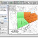
Enter measurements in rods, chains, meters, yards, inches, fathoms, hands, spans or furlongs. Angles can be given down to minutes and seconds. Can auto-close a plot drawing if the final plot segment is missing. Calculate area. Custom labels and backgrounds. Split single plots into multiple plots. GPS Waypoints and more. ...

Author Sandy Knoll Software
License Demo
Price FREE
Released 2024-12-04
Downloads 1002
Filesize 35.50 MB
Requirements
Installation Instal And Uninstall
Keywords plot map, calculate square feet, calculate acreage, calculator, acreage, perimeter
Users' rating
(30 rating)
Metes and BoundsOtherWindows 11, Windows 10 32/64 bit, Windows 8 32/64 bit, Windows 7 32/64 bit
Metes and Bounds data mapping - Download Notice

Using Metes and Bounds Free Download crack, warez, password, serial numbers, torrent, keygen, registration codes, key generators is illegal and your business could subject you to lawsuits and leave your operating systems without patches. We do not host any torrent files or links of Metes and Bounds on rapidshare.com, depositfiles.com, megaupload.com etc. All Metes and Bounds download links are direct Metes and Bounds full download from publisher site or their selected mirrors.
Avoid: data mapping oem software, old version, warez, serial, torrent, Metes and Bounds keygen, crack.
Consider: Metes and Bounds full version, data mapping full download, premium download, licensed copy.

Metes and Bounds data mapping - The Latest User Reviews

Most popular Other downloads

Java Graticule 3D

20241205 download

... a versatile platform for visualizing and analyzing geodetic data in three dimensions. **Key Features:** 1. ... Java Graticule 3D excels in rendering complex geodetic data into intuitive 3D models. Users can explore graticules, ...

RouteConverter

3.1.386 download

... to simplify the management and visualization of GPS data. Whether you're a seasoned traveler, an outdoor enthusiast, ... RouteConverter excels in converting, editing, and displaying GPS data in various formats. The software supports an extensive ...

ExpertGPS

9.05 download

... by TopoGrafix, is a robust and versatile GPS mapping software designed to cater to the needs of ... and tracks. Users can effortlessly import and export data between their GPS devices and the software, making ...

FreeMind

1.0.1 download

... Mind-Mapping tool and an intuitive editor for tree-structured data. The recent development has hopefully turned it into ... other when it seems appropriate. Keeping a small database of something with structure that is either very ...

Unipro UGENE

51.0 download

... to facilitate the analysis and visualization of biological data. This open-source platform integrates a wide array of ... knowledge. The software supports a variety of biological data formats, ensuring compatibility with numerous datasets and facilitating ...

My Family Tree

14.1.1.0 download

... user-friendly interface, which allows for easy navigation and data entry. Users can quickly add family members, relationships, ... history. The software supports a wide range of data types, including photos, videos, and documents, enabling users ...

5 award

Desktop Projector

3.4.0 download

... G.Projector excels in its ability to convert geographic data into over 90 different map projections, including popular ... its capabilities effectively. Users can easily import geographic data in various formats, including shapefiles and raster images, ...

Pepakura Designer

6.0.5 download

... tool designed for creating papercraft models from 3D data. This innovative software transforms complex 3D models into ... offers several advanced functionalities. The software supports texture mapping, allowing users to apply custom textures to their ...

Easy OpenstreetMap Downloader

6.620 download

... enthusiasts, GIS professionals, and anyone requiring detailed map data for offline use. This tool stands out for ... suitable for both small-scale projects and more extensive mapping endeavors. The download process is optimized to ensure ...

MapTiler Engine

14.0.2 download

... professionals, and developers who need to transform geospatial data into high-quality map tiles. This powerful tool excels ... map tiling. Users can effortlessly upload their geospatial data, select the desired output format, and customize various ...