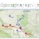
OkMap Desktop 18.8.0
... paths by creating waypoints, routes and tracks, Uploads/downloads data to/from your GPS, Uses altitude DEM data, Supports GPS real-time navigation, Sends/receives vehicles position and display tracks on maps in real time, Provides autorouting and geocoding functions, Supports integration with Google Maps and Earth (in 3D also). ...
| Author | Manuela Silvestri |
| License | Free To Try |
| Price | $27.60 |
| Released | 2024-11-19 |
| Downloads | 3232 |
| Filesize | 44.03 MB |
| Requirements | Microsoft Framework 4.5 |
| Installation | Install and Uninstall |
| Keywords | gps software, map software, poi, waypoint, route, track, geocoding, nmea, projection, calibrate, georeference, raster, digital, vectorial |
| Users' rating (39 rating) |
Using OkMap Desktop Free Download crack, warez, password, serial numbers, torrent, keygen, registration codes,
key generators is illegal and your business could subject you to lawsuits and leave your operating systems without patches.
We do not host any torrent files or links of OkMap Desktop on rapidshare.com, depositfiles.com, megaupload.com etc.
All OkMap Desktop download links are direct OkMap Desktop full download from publisher site or their selected mirrors.
Avoid: data navigation oem software, old version, warez, serial, torrent, OkMap Desktop keygen, crack.
Consider: OkMap Desktop full version, data navigation full download, premium download, licensed copy.


