Elshayal Smart 23.02

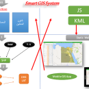
Download Maps from Google Earth, and Trace & save GPS route and View and Rectify Raster Images gif, jpg, bmp and Edit shape files, build new layer, add existing layer, remove layers, swap layers, save layer, set layer data source, layer properties, zoom in & zoom out, pan, identify, selecting features, invert selection, show data table, data query builder, location query builder, build network. ...

Author Elshayal Smart Web On Line Software
License Freeware
Price FREE
Released 2023-02-28
Downloads 197
Filesize 6.00 MB
Requirements
Installation Instal And Uninstall
Keywords edit map, GIS editor, edit GIS, GIS, editor, raster
Users' rating
(14 rating)
Elshayal SmartCADWindows Vista, Windows Vista x64, Windows 7, Windows 7 x64, Windows 8, Windows 8 x64, Windows 10, Windows 10 x64
Elshayal Smart earth map - Download Notice

Using Elshayal Smart Free Download crack, warez, password, serial numbers, torrent, keygen, registration codes, key generators is illegal and your business could subject you to lawsuits and leave your operating systems without patches. We do not host any torrent files or links of Elshayal Smart on rapidshare.com, depositfiles.com, megaupload.com etc. All Elshayal Smart download links are direct Elshayal Smart full download from publisher site or their selected mirrors.
Avoid: earth map oem software, old version, warez, serial, torrent, Elshayal Smart keygen, crack.
Consider: Elshayal Smart full version, earth map full download, premium download, licensed copy.

Elshayal Smart earth map - The Latest User Reviews

Most popular CAD downloads

Mobile Atlas Creator for Mac OS X

2.2.1 download

... exported as one large PNG image with calibration MAP file for OziExplorer. As source for an offline ... OpenStreetMap, Google Maps, Yahoo Maps and other online map providers. Features: Create offline atlases for ...

Geographic Calculator

2020 SP2 download

... license required), a new quick launch for Google Earth and support for the Finland Geiod FIN2000N00. Features: · Interactive conversion · Point database conversion · Seismic survey conversion ...

GeoMapApp

3.7.1 download

GeoMapApp is a map-based application for browsing, visualizing and analyzing a diverse ... Imported table values can be edited and the map symbol, color and size are adjustable. Tabular values ... and geodetic velocity vectors. The GMRT base map provides multi-resolution global elevation data upon which other ...

Topography in AutoCAD

2.3 download

... you can draw a DWG file in Google Earth, by generating a 2D or 3D KML file type. The DWG file can be in any projected coordinate system and from ...

TRIANGULATION for AutoCAD

2.3 download

... you can draw a DWG file in Google Earth, by generating a 2D or 3D KML file type. The DWG file can be in any projected coordinate system and from ...

GEOPoint

5.1 download

... pointing angles from a given location on the earth towards a specified geostationary satellite. The program also ... interface for data entry and calculation; entry of earth station location coordinates directly, or by clicking on ...

5 award

JMARS

3.1.5 download

... has branched out to work with data for Earth and the Moon, for which separate versions now ... be created by drawing multi-segment lines on the map, making it easy to sample elevation, thermal inertia, ...

JMARS for Windows

3.1.5 download

... has branched out to work with data for Earth and the Moon, for which separate versions now ... be created by drawing multi-segment lines on the map, making it easy to sample elevation, thermal inertia, ...

TrueSpace

7.61 download

... content for online shared spaces, and for Virtual Earth. Features: Export to Virtual Earth and X format: · An entirely re-written X ... · Also included is an export to Virtual Earth which will let you place your 3D creations ...

Mobile Atlas Creator

2.2.1 download

... exported as one large PNG image with calibration MAP file for OziExplorer. As source for an offline ... OpenStreetMap, Google Maps, Yahoo Maps and other online map providers. Features: Create offline atlases for ...