- Software
- - Graphic Apps
- - CAD
- - TNTatlas
TNTatlas 2024 B20240606
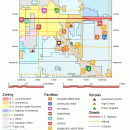
... — from a single geodata file to complex map layouts prepared using TNTmips. TNTatlas lets you display massive sized geodata and will directly display numerous file formats including shapefiles, GeoTIFF, JP2, PNG, MrSID, DXF, and DWG. ...
| Author | MicroImages, Inc. |
| License | Freeware |
| Price | FREE |
| Released | 2024-06-06 |
| Downloads | 1194 |
| Filesize | 59.00 MB |
| Requirements | |
| Installation | Instal And Uninstall |
| Keywords | geospatial viewer, view atlas, visualize geospatial data, atlas, map, viewer |
| Users' rating (40 rating) |
Using TNTatlas Free Download crack, warez, password, serial numbers, torrent, keygen, registration codes,
key generators is illegal and your business could subject you to lawsuits and leave your operating systems without patches.
We do not host any torrent files or links of TNTatlas on rapidshare.com, depositfiles.com, megaupload.com etc.
All TNTatlas download links are direct TNTatlas full download from publisher site or their selected mirrors.
Avoid: electronic map oem software, old version, warez, serial, torrent, TNTatlas keygen, crack.
Consider: TNTatlas full version, electronic map full download, premium download, licensed copy.


