ORTWIN 20.02

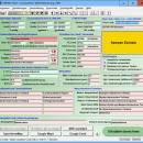
ORTWIN is a program for the inquiry of localities, postal codes and telephone selections in Germany. It finds coordinates and ground level elevations, municipal codes, local center points, car license codes, topographic maps, Unlocodes and much more. It arranges localities hierarchically in different administrative units. It performs perimeter searches and distance calculations. It finds landscapes, natural units and snow- and wind load zones. ...

Author Killet GeoSoftware Ing.-GbR
License Free To Try
Price $120.00
Released 2024-03-06
Downloads 379
Filesize 4.86 MB
Requirements Pentium, 50 MB HD
Installation Install and Uninstall
Keywords local, index, register, place, locality, town, city, cities, quarter, geo, coding, periphery, perimeter, search, distance, municipality, district, coordinate, coordinates, elevation, longitude, latitude, snow load, wind load, landscape, center, distance, transformation
Users' rating
(13 rating)
ORTWINDatabases & ToolsWin2000, Windows XP, Windows 7 x32, Windows 7 x64, Windows 8, Windows 10, WinServer, WinOther, Windows 2000, Windows 2003, Windows Server 2000, Windows Server 2003, Windows Server 2008, Windows Server 2008r2, Windows Server 2012, Windows Tablet PC Edition 2005, Windows Media Center Editi
ORTWIN federal - Download Notice

Using ORTWIN Free Download crack, warez, password, serial numbers, torrent, keygen, registration codes, key generators is illegal and your business could subject you to lawsuits and leave your operating systems without patches. We do not host any torrent files or links of ORTWIN on rapidshare.com, depositfiles.com, megaupload.com etc. All ORTWIN download links are direct ORTWIN full download from publisher site or their selected mirrors.
Avoid: federal oem software, old version, warez, serial, torrent, ORTWIN keygen, crack.
Consider: ORTWIN full version, federal full download, premium download, licensed copy.

ORTWIN federal - The Latest User Reviews

Most popular Databases & Tools downloads

TOPOWIN

23.02 download

... of the land surveying authorities of many German Federal States. For the first time in the previous version TOPO (for DOS) and later in TOPOWIN state-wide topographic information were arranged ...

Geodata Germany

28.01 download

The database tables contains geodata of the Federal Republic of Germany with geo referenced towns, municipalities, ... hierarchies. So it can be determined to which federal state, governmental area or governmental county a town, ...

Geodata Germany

28.01 download

The database tables contains geodata of the Federal Republic of Germany with geo referenced towns, municipalities, ... hierarchies. So it can be determined to which federal state, governmental area or governmental county a town, ...

Payments

4.0 download

... of the electronic messages (ED) between Handle of federal exchequer and Managers of the not tax incomes ... conversion of the payables and summary registry of federal exchequer from files of the exchange format (*.arj) ...

TOPOWIN

20.01 download

... of the land surveying authorities of many German Federal States. For the first time in the previous version TOPO (for DOS) and later in TOPOWIN state-wide topographic information were arranged ...

ORTWIN

17.03 download

... more. It arranges localities hierarchically into the structures federal state, administrative district, rural district, town, municipality, local quarter and domicile. The program performs perimeter searches and distance calculations. It finds ...

Geodata Germany

28.01 download

The database tables contains geodata of the Federal Republic of Germany with geo referenced towns, municipalities, ... hierarchies. So it can be determined to which federal state, governmental area or governmental county a town, ...

Call Center Manager

9.0.5 download

... of activity and availability along with compliance with Federal Telemarketing Rules -Automatically tracks and adjusts Call Drop thresholds and dialing pace to comply with U.S. Federal Trade Commission's Telemarketing Sales Rule on Dropped Calls. ...

ORTWIN

20.02 download

... more. It arranges localities hierarchically into the structures federal state, administrative district, rural district, town, municipality, local quarter and domicile. The program performs perimeter searches and distance calculations. It finds ...

Geodata Germany

28.01 download

The database tables contains geodata of the Federal Republic of Germany with geo referenced towns, municipalities, ... hierarchies. So it can be determined to which federal state, governmental area or governmental county a town, ...