QGIS for Mac 3.36.1

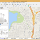
QGIS supports vector, raster, and database formats and lets you browse and create map data on your computer.
QGIS supports many common spatial data formats (e.g. ESRI ShapeFile, geotiff). QGIS supports plugins to do things like display tracks from your GPS.
QGIS aims to be an easy to use GIS, providing common functions and features. The initial goal was to provide a GIS data viewer. ...

Author Gary Sherman
License Open Source
Price FREE
Released 2024-03-26
Downloads 247
Filesize 1600.00 MB
Requirements MacOS High Sierra (10.13) and newer
Installation Instal And Uninstall
Keywords geographic information system, map creator, map viewer, GIS, geographic information, create, QGIS for Mac
Users' rating
(30 rating)
QGIS for MacCADMac OS X
QGIS for Mac file - Download Notice

Using QGIS for Mac Free Download crack, warez, password, serial numbers, torrent, keygen, registration codes, key generators is illegal and your business could subject you to lawsuits and leave your operating systems without patches. We do not host any torrent files or links of QGIS for Mac on rapidshare.com, depositfiles.com, megaupload.com etc. All QGIS for Mac download links are direct QGIS for Mac full download from publisher site or their selected mirrors.
Avoid: file oem software, old version, warez, serial, torrent, QGIS for Mac keygen, crack.
Consider: QGIS for Mac full version, file full download, premium download, licensed copy.

QGIS for Mac file - The Latest User Reviews

Most popular CAD downloads

PDF to DWG Converter

9.5 download

... that allows you to batch convert your PDF files to usable and editable AutoCAD DWG or DXF files, so you can recover the entities in PDF ... 5. Batch convert all pages in each PDF file. 6. Extract embedded raster images from PDF files. ...

AutoCAD 2020

2025 download

... Menu Browser: Reviewing and working with several files is no longer a tedious and time-consuming process. ... new menu browser interface allows you to browse files and examine thumbnail images and provides detailed information ...

InnerSoft CAD for AutoCAD 2007

3.8 download

... block definitions of a drawing in individual AutoCAD files (each block definition in a single file); Sum the area or length property of a ...

RTOPO Hydrology

3.4Half download

... entities, you can do: -load and draw a file of points having the format: Number X Y ... modifiable library of codes -edit interactively the XYZ files of points; you can modify the coordinates, the ...

BricsCad Classic

24.2.06-1 download

... menu customization. · Highly compatible with DWG 2007 file format. · Support for DWG versions 2.5 to 2009. · Full ACIS (3D solids) modeling. · Associative Dimensions. · Reference Edit. ...

Br3D

1.3 download

... weight, fast free 3D Viewer Supports various 3D file format. Read : DWG, DXF, IFC, IFCZIP, STL, ... Background Color General Option For Saving As Image File Association ...

WindRose PRO

3.1.54.0 download

... can be loaded as comma separated values (CSV) files or from Excel files. Plots can be saved in BMP format ... as shapefiles for GIS environments and as KML files for Google Earth. Numerical data can be ...

ChemDoodle

9.1.0 download

... ChemDoodle also natively reads and writes many common file formats including ChemDraw's CDX and CDXML. You can write ChemDraw files for submitting journal manuscripts or share these files with your rich friends who purchased ChemDraw. No ...

VariCad 2011 for Linux

1.06 download

... and then use it to automatically create drawings files, or you can draw only in 2D. Designing ... is defined, any changes made to the part file are reflected in the assembly file and vice-versa. ...

GEOPoint

5.1 download

... ability to save the current map image to file. ability to save azimuth and elevation contours to a KML file for viewing in Google Earth. estimation of site ... select earth station location from a user supplied file containing a list of sites; view and save ...

5 award