Acme CAD See 6.6

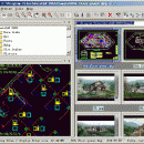
AutoCAD DWG viewer and browser.The fastest and easiest-to-use DWG DXF DWF ... JPEG TIFF PCX TGA PNG MNG GIF ... file viewer available for Windows 95/98/ME/NT/2000/XP/Win7/Win10! AcmeCADSee is two tools in one. A full-featured drawing viewer quickly displays your images in high quality. The drawing file browser lets you efficiently find and organize your drawing file.Supports AutoCAD R2.5-R2018 DWG,DXF,DWF format ...

Author DWG TOOL Software
License Free To Try
Price $59.95
Released 2017-11-13
Downloads 89
Filesize 6.66 MB
Requirements 1G CPU, 1G memory, Winxp, Win7, Win8, Win10
Installation Install and Uninstall
Keywords dwg viewer, dxf, dwf
Users' rating
(10 rating)
Acme CAD SeeCADWin2000, Windows XP, Windows 7 x32, Windows 7 x64, Windows 8, Windows 10, WinServer, WinOther, Windows Vista, Windows Vista x64
Acme CAD See file viewer - Download Notice

Using Acme CAD See Free Download crack, warez, password, serial numbers, torrent, keygen, registration codes, key generators is illegal and your business could subject you to lawsuits and leave your operating systems without patches. We do not host any torrent files or links of Acme CAD See on rapidshare.com, depositfiles.com, megaupload.com etc. All Acme CAD See download links are direct Acme CAD See full download from publisher site or their selected mirrors.
Avoid: file viewer oem software, old version, warez, serial, torrent, Acme CAD See keygen, crack.
Consider: Acme CAD See full version, file viewer full download, premium download, licensed copy.

Acme CAD See file viewer - The Latest User Reviews

Most popular CAD downloads

Mini CAD Viewer

3.7.0.0 download

Mini CAD Viewer is a compact free CAD viewer.It is designed to be easy to use, even ... supports DWG, DWF, DXF formats. It allows drawing file to be printed. ...

MicroDicom

2024.2 download

... *.bmp, *.gif, etc) Open and save DICOM directory files Display of patient list from DICOMDIR Display images ... images to the most common picture formats, movie file format(.avi) and clipboard Brightness/contrast control Zooming and panning ...

MicroDicom x64

2024.2 download

... *.bmp, *.gif, etc) Open and save DICOM directory files Display of patient list from DICOMDIR Display images ... images to the most common picture formats, movie file format(.avi) and clipboard Brightness/contrast control Zooming and panning ...

VisualCAM

1.0.5.0 download

VisualART 1.0 requires the VisualCAM 1.0 base platform to be installed. If you have not installed VisualCAM 1.0 please install that first before installing VisualART 1.0. You will not be ...

QFitsView

8.6 download

... analyzing astronomical images, supporting a wide array of file formats including FITS, which is the standard in the field. Its intuitive interface allows users to seamlessly navigate through multi-dimensional data, ...

MagicPlot Viewer

2.0 download

... for viewing plots and thumbnails from multiple text/ASCII files. Plotvisor's appearance is similar to that of popular image viewers: there is the directory tree, thumbnails and preview area. Text file format and columns to be plotted can be ...

TNTatlas

2024 B20240606 download

TNTatlas is a powerful free geodata viewer that lets you publish and distribute your maps and geospatial data — from a single geodata file to complex map layouts prepared using TNTmips. TNTatlas ...

VariCAD Viewer for Linux

2024 2.01 download

VariCAD Viewer is a free viewer, convertor and printing software working with 2D DWG, DXF, 3D STEP and 2D/3D VariCAD file formats. VariCAD viewer allows you to convert DWG to DXF and ...

VIPER

3.49 B467 download

... mass. It can read MS data from several file formats: .PEK, .CSV (Decon2LS format), .mzXML, and .mzData. See the Readme.txt file installed with VIPER for additional details on the various file formats. VIPER runs on Windows computers and requires ...

TNTatlas for Mac OS X

2024 B20240508 download

TNTatlas is a powerful free geodata viewer that lets you publish and distribute your maps and geospatial data — from a single geodata file to complex map layouts prepared using TNTmips. TNTatlas ...