World Heatmap Creator 1.4

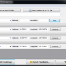
... these statistical instruments are capable of representing large data sets in a simple manner. World Heatmap Creator creates a world map in HTML format and marks all the locations you choose. The software displays a drop-down list of all the countries in the world, storing a specific location for each. ...

Author VOVSOFT
License Free To Try
Price $19.99
Released 2018-10-16
Downloads 105
Filesize 1.60 MB
Requirements Windows XP or later.
Installation Install and Uninstall
Keywords map, heatmap, heat map, world, chart, world chart
Users' rating
(7 rating)
World Heatmap CreatorOtherWin2000, Windows XP, Windows 7 x32, Windows 7 x64, Windows 8, Windows 10, WinServer, WinOther, Windows Vista, Windows Vista x64
World Heatmap Creator geographic data - Download Notice

Using World Heatmap Creator Free Download crack, warez, password, serial numbers, torrent, keygen, registration codes, key generators is illegal and your business could subject you to lawsuits and leave your operating systems without patches. We do not host any torrent files or links of World Heatmap Creator on rapidshare.com, depositfiles.com, megaupload.com etc. All World Heatmap Creator download links are direct World Heatmap Creator full download from publisher site or their selected mirrors.
Avoid: geographic data oem software, old version, warez, serial, torrent, World Heatmap Creator keygen, crack.
Consider: World Heatmap Creator full version, geographic data full download, premium download, licensed copy.

World Heatmap Creator geographic data - The Latest User Reviews

Most popular Other downloads

uDig

2.0.0 download

... provide a complete Java solution for desktop GIS data access, editing, and viewing. uDig aims to be: User friendly, providing a familiar graphical environment for GIS users; Desktop ...

Google Photos

1.1.4.11 download

... Google Photos recognizes faces, grouping similar ones together; geographic landmarks (such as the Eiffel Tower); and subject ... as they age. The Places category uses geotagging data but can also determine locations in older pictures ...

GeoTagNinja

Build 9300 [20250618 download

... core, GeoTagNinja excels in its primary function: embedding geographic coordinates into your photos' metadata. This feature is ... devices and track logs. Users can import GPS data directly from their devices or use GPX files ...

ATOM GPS

1.0.5 download

... This action allows you to write the geolocation data to your photos exifs (information stored about your ... Geotagging your photos you can sort them by geographic location for easy browsing, and also upload your ...

MAPublisher

11.5.2 download

... visually stunning maps with the precision of GIS data. The software supports a wide range of GIS data formats, including shapefiles, GeoJSON, KML, and more, ensuring compatibility with various data sources. This versatility makes it an indispensable tool ...

uDig x64

1.4.0 download

... provide a complete Java solution for desktop GIS data access, editing, and viewing. uDig aims to be: User friendly, providing a familiar graphical environment for GIS users; Desktop ...

uDig for Mac OS X

1.4.0 download

... provide a complete Java solution for desktop GIS data access, editing, and viewing. uDig aims to be: User friendly, providing a familiar graphical environment for GIS users; Desktop ...

uDig for Linux

1.4.0 download

... provide a complete Java solution for desktop GIS data access, editing, and viewing. uDig aims to be: User friendly, providing a familiar graphical environment for GIS users; Desktop ...

Google Photos for Mac OS X

1.1.2.13 download

... Google Photos recognizes faces, grouping similar ones together; geographic landmarks (such as the Eiffel Tower); and subject ... as they age. The Places category uses geotagging data but can also determine locations in older pictures ...

Google Photos for iOS

2.12.0 download

... Google Photos recognizes faces, grouping similar ones together; geographic landmarks (such as the Eiffel Tower); and subject ... as they age. The Places category uses geotagging data but can also determine locations in older pictures ...