TNTmips for Mac OS X 20240111

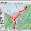
TNTmips is a geospatial image processing tool that allows you to analyze and modify GIS images. It is a professional application that can handle desktop cartography, electronic atlas preparation and spatial database management. ...

Author MicroImages, Inc.
License Freeware
Price FREE
Released 2024-01-11
Downloads 234
Filesize 87.90 MB
Requirements Mac (OS 10.8 to 11), XQuartz 2.7.9 needed (2.7.11 with manual modification)
Installation Instal And Uninstall
Keywords GIS data analysis, analyze geodetic data, edit GIS dataset, GIS, dataset, editor, analysis, mac os, TNTmips for mac, TNTgis for mac, TNTedit
Users' rating
(29 rating)
TNTmips for Mac OS XCADMac OS X
TNTmips for Mac OS X geospatial tool - Download Notice

Using TNTmips for Mac OS X Free Download crack, warez, password, serial numbers, torrent, keygen, registration codes, key generators is illegal and your business could subject you to lawsuits and leave your operating systems without patches. We do not host any torrent files or links of TNTmips for Mac OS X on rapidshare.com, depositfiles.com, megaupload.com etc. All TNTmips for Mac OS X download links are direct TNTmips for Mac OS X full download from publisher site or their selected mirrors.
Avoid: geospatial tool oem software, old version, warez, serial, torrent, TNTmips for Mac OS X keygen, crack.
Consider: TNTmips for Mac OS X full version, geospatial tool full download, premium download, licensed copy.

TNTmips for Mac OS X geospatial tool - The Latest User Reviews

Most popular CAD downloads

TNTatlas for Mac OS X

2024 B20240508 download

... lets you publish and distribute your maps and geospatial data — from a single geodata file to ... GeoTIFF, JP2, PNG, MrSID, DXF, and DWG. Geospatial information plays a growing part in the way ...

TNTmips

20240404 download

... lets you work with virtually any type of geospatial data including imagery, terrain surfaces, and map data with associated database attributes. It provides all the tools you need to view, create, edit, georeference, interpret, ...

TNTatlas

2024 B20240606 download

... lets you publish and distribute your maps and geospatial data — from a single geodata file to ... GeoTIFF, JP2, PNG, MrSID, DXF, and DWG. Geospatial information plays a growing part in the way ...

Geographic Calculator

2020 SP2 download

... to upgrade and get more information. Powerful geospatial data conversion and translation made easy! Believe it ... 2013 also introduces a new streamlined license manager tool with automatic online licensing, the BMG Reprojector for ...

TNTmips for Mac OS X

20240111 download

... lets you work with virtually any type of geospatial data including imagery, terrain surfaces, and map data with associated database attributes. It provides all the tools you need to view, create, edit, georeference, interpret, ...

JMARS

3.1.5 download

... and Analysis for Remote Sensing. It is a geospatial information system (GIS) developed by ASU's Mars Space Flight Facility to provide mission planning and data-analysis tools to NASA's orbiters, instrument team members, students of ...

JMARS for Windows

3.1.5 download

... and Analysis for Remote Sensing. It is a geospatial information system (GIS) developed by ASU's Mars Space Flight Facility to provide mission planning and data-analysis tools to NASA's orbiters, instrument team members, students of ...