- Software
- - Graphic Apps
- - Viewers
- - PIE
PIE 7.63
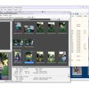
... TIFF and RAW files. Imports photos, renames, rotates. Geotagging of photos with interactive map. File manager and fast viewer with slide show. ExifTool based metadata engine with unique multicore control. Support for .ARW .SR2 .CRW .CR2 .DNG .ERF .DCR .KDC .MEF .MRW .NEF .ORF .PEF .RAF .RAW files. ...
| Author | Picmeta Systems |
| License | Freeware |
| Price | FREE |
| Released | 2024-05-14 |
| Downloads | 1568 |
| Filesize | 17.15 MB |
| Requirements | |
| Installation | Install and Uninstall |
| Keywords | digital camera, picture, metadata, meta, exif, xmp, iptc, gps, picture information, rename, redate, transfer, rotate, lossless, viewer, geotagging, exiftool |
| Users' rating (38 rating) |
Using PIE Free Download crack, warez, password, serial numbers, torrent, keygen, registration codes,
key generators is illegal and your business could subject you to lawsuits and leave your operating systems without patches.
We do not host any torrent files or links of PIE on rapidshare.com, depositfiles.com, megaupload.com etc.
All PIE download links are direct PIE full download from publisher site or their selected mirrors.
Avoid: geotagging oem software, old version, warez, serial, torrent, PIE keygen, crack.
Consider: PIE full version, geotagging full download, premium download, licensed copy.


