dwgConvert 2024 A.11

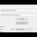
dwgConvert by Guthrie CAD/GIS Software is a powerful tool designed for seamless conversion ... beginners, ensuring high-quality output with minimal effort. The software supports batch processing, saving time on large projects, and maintains the integrity of original designs. Ideal for architects, engineers, and designers, dwgConvert streamlin ... ...

Author Guthrie CAD/GIS Software
License Demo
Price FREE
Released 2024-11-07
Downloads 7
Filesize 34.30 MB
Requirements
Installation
Keywords dwgConvert, download dwgConvert, dwgConvert free download, Convert DWG, DWG converter, AutoCAD converter, DXF2DWG, DWG2DXF, DWG2PDF, DXF2DWG
Users' rating
(4 rating)
dwgConvertOtherWindows 11, Windows 10 32/64 bit, Windows Server 2012, Windows 8 32/64 bit
dwgConvert gis software - Download Notice

Using dwgConvert Free Download crack, warez, password, serial numbers, torrent, keygen, registration codes, key generators is illegal and your business could subject you to lawsuits and leave your operating systems without patches. We do not host any torrent files or links of dwgConvert on rapidshare.com, depositfiles.com, megaupload.com etc. All dwgConvert download links are direct dwgConvert full download from publisher site or their selected mirrors.
Avoid: gis software oem software, old version, warez, serial, torrent, dwgConvert keygen, crack.
Consider: dwgConvert full version, gis software full download, premium download, licensed copy.

dwgConvert gis software - The Latest User Reviews

Most popular Other downloads

ExpertGPS

9.13 download

... TopoGrafix, is a robust and versatile GPS mapping software designed to cater to the needs of outdoor enthusiasts, professional surveyors, and GIS specialists alike. This comprehensive tool seamlessly integrates with ... accurate and up-to-date information at their fingertips. The software supports both USGS topo maps and seamless aerial ...

New Version

FME Desktop

2025.0 Build 25208 download

FME Desktop, developed by Safe Software Inc., is a powerful and versatile data integration ... with complex data workflows across various industries, including GIS, CAD, BIM, and more. At its core, ...

HPGL2CAD

2024 A.06 download

HPGL2CAD, developed by Guthrie CAD/GIS Software, is a specialized conversion tool designed to seamlessly ... CAD formats such as DWG and DXF. This software is particularly valuable for professionals in the fields ...

Offline Map Maker

8.332 download

... Maker by allmapsoft.com is a robust and versatile software designed for users who need to download and ... Google Maps, Bing Maps, OpenStreetMap, and more. The software supports multiple map types such as satellite, terrain, ...

Google Earth for Mac OS X

7.3.6.10155 download

... and detail. Originally designed for professional use, this software has become an invaluable resource for educators, researchers, ... the serene landscapes of the Swiss Alps, the software delivers an immersive experience that is both educational ...

Autoshaper

1.4.3 download

Autoshaper by Automapki is an innovative software solution designed to streamline and enhance the process of creating and manipulating vector shapes within GIS (Geographic Information System) environments. Tailored for professionals and ...

HEC-RAS

6.6 download

... Engineering Center (HEC), is a sophisticated and versatile software suite designed for hydraulic modeling and analysis. This ... steady and unsteady flow river hydraulics calculations. The software's robust computational engine allows users to model complex ...

Metes and Bounds

6.2.4 download

Metes and Bounds is a software that can create plot maps, perform calculations in ... data, let our Metes and Bounds land plotting software finish it for you. Have a bad or ...

Automesher

2.5.4 download

Automesher by Automapki is a versatile and robust software solution designed to streamline the conversion and manipulation of 3D models across various CAD and GIS platforms. Tailored for professionals in fields such as ...

Easy OpenstreetMap Downloader

6.620 download

"Easy OpenstreetMap Downloader" by allmapsoft.com is a specialized software designed to cater to the needs of cartography enthusiasts, GIS professionals, and anyone requiring detailed map data for ... stitched together to form a comprehensive map. The software supports a variety of zoom levels, ensuring that ...