EWDraw 3D ActiveX 15.8.7.3

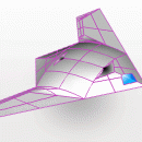
EWDraw is a powerful vector graphics ActiveX for 2D and 3D visualisation and animation. You can use it for CAD,GIS and others. The EWDraw is based on Open CASCADE geometric kernel v 5.2 and openGL. The library is realized as a run-time Windows 32 bit OCX (ActiveX control). Either can be used with applications written in the popular Visual IDE languages such as Delphi, Visual Basic, C++ Builder , Visual C, .NET and INTERNET. ...

Author East Wind Software
License Trialware
Price $899.00
Released 2016-12-01
Downloads 546
Filesize 64.70 MB
Requirements
Installation Instal And Uninstall
Keywords vector graphic visualization, 2d visualisation, 3d animation, vector graphic, animation, animate
Users' rating
(16 rating)
EWDraw 3D ActiveXOtherWindows 2000, Windows 2003, Windows XP, Windows Vista, Windows Vista x64, Windows 7, Windows 7 x64, Windows 8, Windows 8 x64, Windows 10, Windows 10 x64
EWDraw 3D ActiveX gis - Download Notice

Using EWDraw 3D ActiveX Free Download crack, warez, password, serial numbers, torrent, keygen, registration codes, key generators is illegal and your business could subject you to lawsuits and leave your operating systems without patches. We do not host any torrent files or links of EWDraw 3D ActiveX on rapidshare.com, depositfiles.com, megaupload.com etc. All EWDraw 3D ActiveX download links are direct EWDraw 3D ActiveX full download from publisher site or their selected mirrors.
Avoid: gis oem software, old version, warez, serial, torrent, EWDraw 3D ActiveX keygen, crack.
Consider: EWDraw 3D ActiveX full version, gis full download, premium download, licensed copy.

EWDraw 3D ActiveX gis - The Latest User Reviews

Most popular Other downloads

Agisoft Metashape Professional

2.2.1 Build 20103 download

... the world, making it an ideal choice for GIS professionals. The ability to generate high-resolution orthomosaics and ... models and spatial data. Whether you're working in GIS, cultural heritage, visual effects, or scientific research, Metashape ...

MAPublisher

11.4 download

... map-making powerhouse. This software is tailored for cartographers, GIS professionals, and graphic designers who demand precision and ... create visually stunning maps with the precision of GIS data. The software supports a wide range of ...

uDig for Linux

1.4.0 download

... to provide a complete Java solution for desktop GIS data access, editing, and viewing. uDig aims to ... User friendly, providing a familiar graphical environment for GIS users; Desktop located, running as a thick ...

Canvas 11

11.0.173c download

Canvas 11 is the single most cost-effective, integrated solution for the creation, enhancement, presentation and sharing of technical illustrations and graphics. If you work with technical illustrations and graphics, you know ...

uDig x64

1.4.0 download

... to provide a complete Java solution for desktop GIS data access, editing, and viewing. uDig aims to ... User friendly, providing a familiar graphical environment for GIS users; Desktop located, running as a thick ...

ACDSee Canvas 12 with GIS+

12.00.1389 download

... manufacturing, oil, gas and energy, and technology. Canvas’ GIS+ module, included in this evaluation version, offers a powerful set of GIS-based tools and commands that support all leading GIS formats, define complex map projections, and perform advanced ...

TatukGIS Viewer

5.88.0.3244 download

TatukGIS Viewer: A Comprehensive GIS Solution for Professionals and Enthusiasts TatukGIS Viewer, ... application designed to cater to both professionals and GIS enthusiasts. This free, feature-rich software offers an impressive ... is built to handle a wide range of GIS data formats, ensuring seamless integration and compatibility with ...

PlotCalc

2024.11.07 download

... import and export data from popular CAD and GIS applications, facilitating seamless workflows and reducing the need for manual data entry. This interoperability ensures that PlotCalc can fit into existing ...

QField

3.4.7 download

... projects, ensuring that users can take their existing GIS data and workflows into the field without any ... OPENGIS.ch is a powerful, user-friendly, and versatile mobile GIS application that brings the full capabilities of QGIS ...

WeatherStudio

2 download

WeatherStudio combines a vast array of live weather data, products, maps, and charts into a single map that the user can pan and zoom. GFS/NDFD/NAM/RAP Model Data, Placefiles, Radar Loops, Satellite, ...