Elshayal Smart 23.02

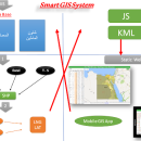
... save GPS route and View and Rectify Raster Images gif, jpg, bmp and Edit shape files, build new layer, add existing layer, remove layers, swap layers, save layer, set layer data source, layer properties, zoom in & zoom out, pan, identify, selecting features, invert selection, show data table, data query builder, location query builder, build network. ...

Author Elshayal Smart Web On Line Software
License Freeware
Price FREE
Released 2023-02-28
Downloads 197
Filesize 6.00 MB
Requirements
Installation Instal And Uninstall
Keywords edit map, GIS editor, edit GIS, GIS, editor, raster
Users' rating
(14 rating)
Elshayal SmartCADWindows Vista, Windows Vista x64, Windows 7, Windows 7 x64, Windows 8, Windows 8 x64, Windows 10, Windows 10 x64
Elshayal Smart image edit - Download Notice

Using Elshayal Smart Free Download crack, warez, password, serial numbers, torrent, keygen, registration codes, key generators is illegal and your business could subject you to lawsuits and leave your operating systems without patches. We do not host any torrent files or links of Elshayal Smart on rapidshare.com, depositfiles.com, megaupload.com etc. All Elshayal Smart download links are direct Elshayal Smart full download from publisher site or their selected mirrors.
Avoid: image edit oem software, old version, warez, serial, torrent, Elshayal Smart keygen, crack.
Consider: Elshayal Smart full version, image edit full download, premium download, licensed copy.

Elshayal Smart image edit - The Latest User Reviews

Most popular CAD downloads

Geneious PRO

6.0.4 download

... translation, complement and protein statistics update as you edit * Find motifs, open reading frames (ORFs) and ... with automated trimming, vector screening, assembly, and chromatogram editing * 454 import and reference assembly with support ...

TNTmips

20240404 download

... with virtually any type of geospatial data including imagery, terrain surfaces, and map data with associated database ... all the tools you need to view, create, edit, georeference, interpret, and publish any type of geospatial ...

SimplyCam

3.66 download

... 2d CAD/CAM system that can directly open, create, edit and save drawings in industry standard DXF format. SimplyCam also convert raster images (Bmp and Jpeg) to vector by drawing centerlines

Easy CAD Viewer

3.3 download

... viewer; it converts DWG, DXF, DWF drawings to image formats such as BMP, JPG, GIF, PNG, TIFF, ... drawings clockwise or anticlockwise for easy review ยท Edit line weight, line types, pen style, point styles, ...

Geneious PRO x64

6.0.4 download

... translation, complement and protein statistics update as you edit * Find motifs, open reading frames (ORFs) and ... with automated trimming, vector screening, assembly, and chromatogram editing * 454 import and reference assembly with support ...

MicroDicom x64

2024.2 download

... application for primary processing and preservation of medical images in DICOM format. It is equipped with most common tools for manipulation of DICOM images and it has an intuitive user interface. ...

JMARS

3.1.5 download

... terabyte of NASA orbiter data, and has basic image and vector processing features to conveniently compare, plot, ... and overlay them into a single, registered multilayer image. * Make topographic profiles, extract surface temperatures (day ...

WellCAD

5.3 B625 download

... based composite log package, which combines comprehensive graphic editing mechanisms and data processing tools. Combining technically excellent display, editing and analysis capabilities for well data, WellCAD has ... incorporates all features and tools necessary to import, edit, process and display your Well data. The software ...

WellCAD x64

5.3 B625 download

... based composite log package, which combines comprehensive graphic editing mechanisms and data processing tools. Combining technically excellent display, editing and analysis capabilities for well data, WellCAD x64 ... incorporates all features and tools necessary to import, edit, process and display your Well data. The software ...

JMARS for Windows

3.1.5 download

... terabyte of NASA orbiter data, and has basic image and vector processing features to conveniently compare, plot, ... and overlay them into a single, registered multilayer image. * Make topographic profiles, extract surface temperatures (day ...