DISLIN for LCC-Win32 10.6

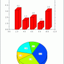
DISLIN is a high-level and easy to use plotting library for displaying data as curves, bar graphs, pie charts, 3D-colour plots, surfaces, contours and maps. Several output formats are supported such as X11, VGA, PostScript, PDF, CGM, SVG, PNG and TIFF. DISLIN is available for the programming languages Fortran 77, Fortran 90 and C. Plotting extensions for the languages Perl, Python and Java are also supported for the most operating systems. ...

Author MPI fuer Sonnensystemforschung
License Freeware
Price FREE
Released 2016-01-18
Downloads 601
Filesize 8.82 MB
Requirements Windows, LCC-Win32
Installation Install and Uninstall
Keywords scientific, plotting, library, programming
Users' rating
(6 rating)
DISLIN for LCC-Win32Components & LibrariesWin2000, Windows 7 x32, Windows Vista, Windows XP
DISLIN for LCC-Win32 image map - Download Notice

Using DISLIN for LCC-Win32 Free Download crack, warez, password, serial numbers, torrent, keygen, registration codes, key generators is illegal and your business could subject you to lawsuits and leave your operating systems without patches. We do not host any torrent files or links of DISLIN for LCC-Win32 on rapidshare.com, depositfiles.com, megaupload.com etc. All DISLIN for LCC-Win32 download links are direct DISLIN for LCC-Win32 full download from publisher site or their selected mirrors.
Avoid: image map oem software, old version, warez, serial, torrent, DISLIN for LCC-Win32 keygen, crack.
Consider: DISLIN for LCC-Win32 full version, image map full download, premium download, licensed copy.

DISLIN for LCC-Win32 image map - The Latest User Reviews

Most popular Components & Libraries downloads

DISLIN for Salford FTN90

10.6 download

... scaled and labeled with linear, logarithmic, date, time, map and user-defined formats. - Plotting of curves. Several ... 3-D colour graphics. - 3-D graphics. - Elementary image routines. - Geographical projections and plotting of maps. ...

DISLIN for MS Visual C++

10.6 download

... scaled and labeled with linear, logarithmic, date, time, map and user-defined formats. - Plotting of curves. Several ... 3-D colour graphics. - 3-D graphics. - Elementary image routines. - Geographical projections and plotting of maps. ...

AspMap

4.9 download

... AJAX. AspMap gives you the ability to generate map images, drill-down capability, thematic mapping, point-to-point routing and other ... generated on the server - will make the map images fully interactive on the client-side. AspMap can ...

DISGCL, DISLIN Graphics Command Language

10.6 download

... scaled and labeled with linear, logarithmic, date, time, map and user-defined formats. - Plotting of curves. Several ... 3-D colour graphics. - 3-D graphics. - Elementary image routines. - Geographical projections and plotting of maps. ...

DISLIN for pgf77/pgf90 (wrapper)

10.6 download

... scaled and labeled with linear, logarithmic, date, time, map and user-defined formats. - Plotting of curves. Several ... 3-D colour graphics. - 3-D graphics. - Elementary image routines. - Geographical projections and plotting of maps. ...

TeeChart for .NET

2024 download

... including Annotation, ExtraLegend, ChartImage, SeriesRegion and ColorBand - Image export as bitmap, metafile, JPEG, PNG, GIF, TIFF ... web charts either as static or ajax enhanced images or take advantage of TeeChart's comprehensive, client-side HTML5 ...

DISLIN PDF Manual

9.5 download

... scaled and labeled with linear, logarithmic, date, time, map and user-defined formats. - Plotting of curves. Several ... 3-D colour graphics. - 3-D graphics. - Elementary image routines. - Geographical projections and plotting of maps. ...

DISLIN for Borland C++ 5.5/6.0

10.6 download

... scaled and labeled with linear, logarithmic, date, time, map and user-defined formats. - Plotting of curves. Several ... 3-D colour graphics. - 3-D graphics. - Elementary image routines. - Geographical projections and plotting of maps. ...

DISLIN for Python

10.6 download

... scaled and labeled with linear, logarithmic, date, time, map and user-defined formats. - Plotting of curves. Several ... 3-D colour graphics. - 3-D graphics. - Elementary image routines. - Geographical projections and plotting of maps. ...

NetDiagram ASP.NET Control

6.3 download

... running in a web page · To an image with associated client side image map · Printing and print preview · Create bitmap images Import and Export: · Export images in ...