TNTmips for Mac OS X 20240111

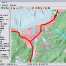
TNTmips is a geospatial image processing tool that allows you to analyze and modify GIS images. It is a professional application that can handle desktop cartography, electronic atlas preparation and spatial database management. ...

Author MicroImages, Inc.
License Freeware
Price FREE
Released 2024-01-11
Downloads 237
Filesize 87.90 MB
Requirements Mac (OS 10.8 to 11), XQuartz 2.7.9 needed (2.7.11 with manual modification)
Installation Instal And Uninstall
Keywords GIS data analysis, analyze geodetic data, edit GIS dataset, GIS, dataset, editor, analysis, mac os, TNTmips for mac, TNTgis for mac, TNTedit
Users' rating
(38 rating)
TNTmips for Mac OS XCADMac OS X
TNTmips for Mac OS X image processing control - Download Notice

Using TNTmips for Mac OS X Free Download crack, warez, password, serial numbers, torrent, keygen, registration codes, key generators is illegal and your business could subject you to lawsuits and leave your operating systems without patches. We do not host any torrent files or links of TNTmips for Mac OS X on rapidshare.com, depositfiles.com, megaupload.com etc. All TNTmips for Mac OS X download links are direct TNTmips for Mac OS X full download from publisher site or their selected mirrors.
Avoid: image processing control oem software, old version, warez, serial, torrent, TNTmips for Mac OS X keygen, crack.
Consider: TNTmips for Mac OS X full version, image processing control full download, premium download, licensed copy.

TNTmips for Mac OS X image processing control - The Latest User Reviews

Most popular CAD downloads

MaxIm DL

6.05 download

... DL is the fastest and easiest way to image the night sky. Whether you want to produce ... tools you need. MaxIm DL includes a complete image processing toolkit that features a large variety of ...

MicroDicom

2024.2 download

MicroDicom is application for primary processing and preservation of medical images in DICOM format. It is equipped with most common tools for manipulation of DICOM images and it has an intuitive user interface. ...

TNTmips

20240404 download

... with virtually any type of geospatial data including imagery, terrain surfaces, and map data with associated database ... without importing. Overlay your geodata on Bing Maps imagery and maps or on geodata layers published on ...

MicroDicom x64

2024.2 download

MicroDicom x64 is application for primary processing and preservation of medical images in DICOM format. It is equipped with most common tools for manipulation of DICOM images and it has an intuitive user interface. ...

SeiSee

2.22.6 download

... the headers and the seismic data. The file processing can be adjusted by changing the gain control and the filter spectrum. SeiSee program shows ... variable area, variable density, color) - scaling seismic image, gain control, axes labeling setup - plots seismic ...

Portable MicroDicom

2024.2 download

MicroDicom is application for primary processing and preservation of medical images in DICOM format. It is equipped with most common tools for manipulation of DICOM images and it has an intuitive user interface. ...

Portable MicroDicom x64

2024.2 download

MicroDicom x64 is application for primary processing and preservation of medical images in DICOM format. It is equipped with most common tools for manipulation of DICOM images and it has an intuitive user interface. ...

TNTmips for Mac OS X

20240111 download

... with virtually any type of geospatial data including imagery, terrain surfaces, and map data with associated database ... without importing. Overlay your geodata on Bing Maps imagery and maps or on geodata layers published on ...