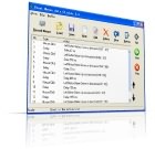
ediTrail 1.0

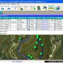
... and flexible table where you can export and import from GPS files, (gpx format). You can manage/view on table all the taken photographs in each trail/waypoint. Each trail/route can be edited over the map with vectorial CAD tools to create, move, split, join, invert trails and trackpoints, (trail vertices). ediTrail works in desktop mode and into CAD systems, (Autocad/Bricscad/Zwcad). ...

Author Aplicaciones Topográficas S.L.
License Freeware
Price FREE
Released 2014-11-07
Downloads 203
Filesize 27.05 MB
Requirements Desktop application, MIcrosoft operating systems, 32&64 bits
Installation Install and Uninstall
Keywords Trail, Route, GPS, gpx, geographical, latitude, longitude, utm, elevation, photo, Track, Way Point, Track Point, hiking, biking, cycling, map, land, terrain, surveying, DTM, D.T.M., digital terrain model, AutoCAD, BricsCAD, CAD, draw, points cloud, contouring, triangulation
Users' rating
(10 rating)
ediTrailOtherWin2000, Windows XP, Windows 7 x32, Windows 7 x64, Windows 8, WinServer, Windows Vista, Windows Vista x64
ediTrail import e - Download Notice

Using ediTrail Free Download crack, warez, password, serial numbers, torrent, keygen, registration codes, key generators is illegal and your business could subject you to lawsuits and leave your operating systems without patches. We do not host any torrent files or links of ediTrail on rapidshare.com, depositfiles.com, megaupload.com etc. All ediTrail download links are direct ediTrail full download from publisher site or their selected mirrors.
Avoid: import e oem software, old version, warez, serial, torrent, ediTrail keygen, crack.
Consider: ediTrail full version, import e full download, premium download, licensed copy.

ediTrail import e - The Latest User Reviews

Most popular Other downloads

Swordfish

5.11.0 download

... feature is complemented by the software's ability to import and export terminology lists in various formats, facilitating collaboration with other tools and stakeholders. Another notable aspect of Swordfish is ...

Cutting Optimization Pro

5.18.9.3 download

... high performance and accuracy. It also supports the import and export of data in multiple formats, facilitating seamless integration with other tools and systems. Moreover, Cutting Optimization Pro provides ...

ExpertGPS

9.14 download

... handle waypoints, routes, and tracks. Users can effortlessly import and export data between their GPS devices and the software, making it simple to plan trips, mark points of interest, and ...

New Version

Desktop Projector

3.4.4 download

... and utilize its capabilities effectively. Users can easily import geographic data in various formats, including shapefiles and raster images, and then apply their chosen projection with just a few clicks. ...

New Version

Multi Collector Premium

7.2.1 download

... providing valuable insights into trends, values, and other important metrics. This functionality is particularly useful for professional ... Another notable feature is the software's ability to import and export data in various formats, making it ...

GRAMPS

5.2.4 download

... accuracy is further supported by its ability to import and export data in GEDCOM format, facilitating seamless data exchange with other genealogy software and online platforms. Gramps is also ...

yoshinoGraph

7.0.2 download

... analysis. **Key Features:** 1. **Versatile Data Importing:** yoshinoGRAPH supports a wide range of data formats, including text files and CSV, allowing users to import data seamlessly. This flexibility ensures that you can ...

Automesher

2.5.4 download

Automesher by Automapki is a versatile and robust software solution designed to streamline the conversion and manipulation of 3D models across various CAD and GIS platforms. Tailored for professionals in fields ...

ediTrail

1.0 download

Importation/Exportation: Import/export trails to gpx file. Unlimited number of trails, and TrackPoints. Export to gpx, Excel, PDF, XPS and KML/KMZ. Data ...

Google Earth for Mac OS X

7.3.6.10155 download

... and decision-making. The software also allows users to import and export GIS data, making it a powerful tool for those working with geographical information systems. In addition to its ...