TNTmips 20240404

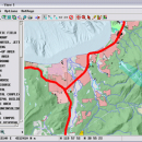
TNTmips is a geospatial image processing tool that allows you to analyze and modify GIS images. It is a professional application that can handle desktop cartography, electronic atlas preparation and spatial database management. ...

Author MicroImages, Inc.
License Freeware
Price FREE
Released 2024-04-04
Downloads 754
Filesize 121.00 MB
Requirements
Installation Instal And Uninstall
Keywords GIS data analysis, analyze geodetic data, edit GIS dataset, GIS, dataset, editor, analysis
Users' rating
(48 rating)
TNTmipsCADWindows XP, Windows Vista, Windows Vista x64, Windows 7, Windows 7 x64, Windows 8, Windows 8 x64, Windows 10, Windows 10 x64, Windows 11
TNTmips information analysis - Download Notice

Using TNTmips Free Download crack, warez, password, serial numbers, torrent, keygen, registration codes, key generators is illegal and your business could subject you to lawsuits and leave your operating systems without patches. We do not host any torrent files or links of TNTmips on rapidshare.com, depositfiles.com, megaupload.com etc. All TNTmips download links are direct TNTmips full download from publisher site or their selected mirrors.
Avoid: information analysis oem software, old version, warez, serial, torrent, TNTmips keygen, crack.
Consider: TNTmips full version, information analysis full download, premium download, licensed copy.

TNTmips information analysis - The Latest User Reviews

Most popular CAD downloads

OpenRocket

14.06 download

... CP position Real-time flight altitude, velocity and acceleration information from a continuous simulation performed in the background ... of components or stages separately Simulation and analysis Full six degree of freedom simulation Rocket ...

DWSIM

6.6.2 download

... Refluxed and Reboiled Absorbers. DWSIM also provides special information about the simulation and different means of inputting ... Characterization, Reactions Manager and User Component Creator Process Analysis and Optimization: Sensitivity Analysis Utility, Multivariate Optimizer with ...

MITCalc Tolerance analysis

1.19 download

Two programs for the tolerance analysis of linear, 2D and 3D dimensional chains 1) Tolerance analysis of linear dimensional chains. The program is designed for tolerance analysis of linear (1D) dimensional chains. The program solves ...

QGIS

3.36.1 download

... files · GRASS integration, including view, edit, and analysis · On the fly projection of vector layers · Map composer · Identify features · Display attribute table · Select features ...

PowerStar

5.22 download

... for use with most electrical engineering design and analysis applications. Use it for commercial building services, industrial ... and print single line diagram. Display complete device information includes node voltages, voltage drops, current, kW, kVA ...

5 award

Geneious PRO x64

6.0.4 download

... as DNA sequences or proteins, phylogenies, 3D structure information, publications, etc. It features sequence alignment and phylogenetic analysis, contig assembly, primer design and cloning, access to ... that Geneious Pro can do for you. Sequence Analysis: * Pairwise and multiple sequence alignment including ...

Thuban for Mac OS X

1.0.1-3 download

... features methods to visualize, explore, and analyze geographic information. Thuban is an Interactive Geographic Data Viewer ... need for a user-friendly, interactive viewer for geographic information. Thuban makes use of several Free GIS ...

QGIS for Linux

3.36.1 download

... files · GRASS integration, including view, edit, and analysis · On the fly projection of vector layers · Map composer · Identify features · Display attribute table · Select features ...

Weather Station Data Logger

5.6.0.0 download

... most of the data available on the console, analysis of wind and temperature data plus graphs of ... the raw console data yields the following additional information: * 15-minute rate of change for temperature ...

TNTmips

20240404 download

TNTmips software is a complete Geographic Information System (GIS) that lets you work with virtually ... of natural terrains and mathematical surfaces from 3D information. Fast and efficient Surface Fitting, Contouring, and Triangulation ...