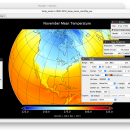
Panoply for Mac 5.4.3
Panoply for Mac is an utility that enable user to plot raster image. Depending on the data, it can draw global longitude-latitude images or pole-to-pole latitude-vertical images.Panoply is a cross-platform application which plots geo-gridded arrays from netCDF, HDF and GRIB datasets. The utility can also combine two arrays and can project the analysis using more than 100 maps. ...
| Author | Robert B. Schmunk |
| License | Freeware |
| Price | FREE |
| Released | 2024-06-24 |
| Downloads | 248 |
| Filesize | 36.40 MB |
| Requirements | |
| Installation | Instal And Uninstall |
| Keywords | plot raster image, longitude image, pole-to-pole image, raster image, rasterize, raster |
| Users' rating (24 rating) |
Using Panoply for Mac Free Download crack, warez, password, serial numbers, torrent, keygen, registration codes,
key generators is illegal and your business could subject you to lawsuits and leave your operating systems without patches.
We do not host any torrent files or links of Panoply for Mac on rapidshare.com, depositfiles.com, megaupload.com etc.
All Panoply for Mac download links are direct Panoply for Mac full download from publisher site or their selected mirrors.
Avoid: kmz oem software, old version, warez, serial, torrent, Panoply for Mac keygen, crack.
Consider: Panoply for Mac full version, kmz full download, premium download, licensed copy.


