ediTrail 1.0

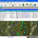
You can manage unlimited trails/routes on a simple and flexible table where you can export and import from GPS files, (gpx format). You can manage/view on table all the taken photographs in each trail/waypoint. Each trail/route can be edited over the map with vectorial CAD tools to create, move, split, join, invert trails and trackpoints, (trail vertices). ediTrail works in desktop mode and into CAD systems, (Autocad/Bricscad/Zwcad). ...

Author Aplicaciones Topográficas S.L.
License Freeware
Price FREE
Released 2014-11-07
Downloads 187
Filesize 27.05 MB
Requirements Desktop application, MIcrosoft operating systems, 32&64 bits
Installation Install and Uninstall
Keywords Trail, Route, GPS, gpx, geographical, latitude, longitude, utm, elevation, photo, Track, Way Point, Track Point, hiking, biking, cycling, map, land, terrain, surveying, DTM, D.T.M., digital terrain model, AutoCAD, BricsCAD, CAD, draw, points cloud, contouring, triangulation
Users' rating
(4 rating)
ediTrailOtherWin2000, Windows XP, Windows 7 x32, Windows 7 x64, Windows 8, WinServer, Windows Vista, Windows Vista x64
ediTrail latitude it - Download Notice

Using ediTrail Free Download crack, warez, password, serial numbers, torrent, keygen, registration codes, key generators is illegal and your business could subject you to lawsuits and leave your operating systems without patches. We do not host any torrent files or links of ediTrail on rapidshare.com, depositfiles.com, megaupload.com etc. All ediTrail download links are direct ediTrail full download from publisher site or their selected mirrors.
Avoid: latitude it oem software, old version, warez, serial, torrent, ediTrail keygen, crack.
Consider: ediTrail full version, latitude it full download, premium download, licensed copy.

ediTrail latitude it - The Latest User Reviews

Most popular Other downloads

Offline Map Maker

8.321 download

... exact area they wish to download by setting latitude and longitude boundaries, ensuring that they get precisely the map sections they need. One of the standout features of Offline ...

ExpertGPS

8.76 download

ExpertGPS, developed by TopoGrafix, is a robust and versatile GPS mapping software designed to cater to the needs of outdoor enthusiasts, professional surveyors, and GIS specialists alike. This comprehensive tool seamlessly ...

New Version

Panoply

5.5.1 download

... can effortlessly create a variety of plots, including latitude-longitude maps, zonal averages, time series, and scatter plots. The software's intuitive interface allows for seamless navigation and manipulation of data, enabling ...

Java Graticule 3D

20240911 download

... explore graticules, which are networks of longitude and latitude lines, in a fully interactive three-dimensional space. This feature is particularly beneficial for understanding spatial relationships and conducting detailed geographical analyses. ...

Google Maps Downloader

8.872 download

... area they wish to download by setting the latitude and longitude coordinates. This level of customization ensures that users only download the regions they need, saving both time and storage ...

ediTrail

1.0 download

Importation/Exportation: Import/export trails to gpx file. Unlimited number of trails, and TrackPoints. Export to gpx, Excel, PDF, XPS and KML/KMZ. Data table: Very flexible data table that allows sorting by columns, ...

gMaps Pro for Windows Phone

download

... bicycle, public transit or walk) + google latitude + venues search using powerful local search + ... button next to the search textbox) Google Latitude: Google Latitude lets you stay close with your ...