Airphoto 3.58

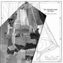
AirPhoto is an easy to use application that can process and edit old photos and calibrate maps. The program is intended for archaeologists that need to superimpose scanned maps and old pictures. The program can be used from a digital terrain model (DTM) if desired. Using AirPhoto, you can obtain images directly from a scanner or create mosaics. ...

Author Irwin Scollar
License Free To Try
Price FREE
Released 2013-04-08
Downloads 188
Filesize 23.20 MB
Requirements
Installation Instal And Uninstall
Keywords image editor, process image, map calibration, editor, edit, calibration
Users' rating
(6 rating)
AirphotoEditorsWindows XP, Windows Vista, Windows Vista x64, Windows 7, Windows 7 x64
Airphoto map application - Download Notice

Using Airphoto Free Download crack, warez, password, serial numbers, torrent, keygen, registration codes, key generators is illegal and your business could subject you to lawsuits and leave your operating systems without patches. We do not host any torrent files or links of Airphoto on rapidshare.com, depositfiles.com, megaupload.com etc. All Airphoto download links are direct Airphoto full download from publisher site or their selected mirrors.
Avoid: map application oem software, old version, warez, serial, torrent, Airphoto keygen, crack.
Consider: Airphoto full version, map application full download, premium download, licensed copy.

Airphoto map application - The Latest User Reviews

Most popular Editors downloads

Panorama Express Professional

3.0 download

... the Skin Editor Tab, the Hotspot Tab, the Map & Compass Tab, the Movie Tab, and the Donut Image Tab Every tab in Panorama Express contains commands that make ...

3DFieldPro

4.6.7.0 download

... from a variety of data sources. This robust application is tailored for professionals in fields such as geophysics, meteorology, oceanography, and environmental science, offering a comprehensive suite of tools to ...

HoudahGeo

6.4.3 download

... like a GPS camera. HoudahGeo is the only application that writes future-proof GPS tags to original images ... add GPS track logs. * Use the built-in map to assign or adjust photo locations. Use reverse ...

HDR Expose

2.1.1 build 9804 download

... HDR software is created equal. Previously, HDR applications performed their contrast manipulation or "tone-mapping" by creating ... That’s why we created our stand-alone HDR application HDR Expose and the Photoshop plug-in 32 Float. ...

HDR Expose 64bit

2.1.1 build 9804 download

... HDR software is created equal. Previously, HDR applications performed their contrast manipulation or "tone-mapping" by creating ... That’s why we created our stand-alone HDR application HDR Expose and the Photoshop plug-in 32 Float. ...

HDR Expose for Mac

3.1 B11384 download

... HDR software is created equal. Previously, HDR applications performed their contrast manipulation or "tone-mapping" by creating ... That’s why we created our stand-alone HDR application HDR Expose and the Photoshop plug-in 32 Float. ...

PIE Studio

5.92 download

... All features of PIE and Printstation in one application: Metadata * Extraction and display of ... and categories * Geotagging of photos with interactive map * Adjust or add EXIF date/time in JPG ...

3DFieldPro x64

4.6.5 download

... volume plots. 3DFieldPro x64 is an advanced software application whose purpose is to help you create 2D/3D ... polygons, 3D view relief contour, and OpenGL 3D map with contours and textures. 3DFieldPro x64 helps you ...

Airphoto

3.58 download

... corresponding control points in a picture and a map just by clicking the mouse. Color or black ... which show data contained within more than one map. Mosaics may be made from multiple color or ...

Picture Frame Wizard

2.0.0.67 download

... date and some text to each pictures. The application automatically extracts the shooting date from each picture. ... you can visualize the exact location on a map. In case you want to save the location ...