Airphoto 3.58

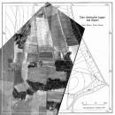
AirPhoto is an easy to use application that can process and edit old photos and calibrate maps. The program is intended for archaeologists that need to superimpose scanned maps and old pictures. The program can be used from a digital terrain model (DTM) if desired. Using AirPhoto, you can obtain images directly from a scanner or create mosaics. ...

Author Irwin Scollar
License Free To Try
Price FREE
Released 2013-04-08
Downloads 190
Filesize 23.20 MB
Requirements
Installation Instal And Uninstall
Keywords image editor, process image, map calibration, editor, edit, calibration
Users' rating
(7 rating)
AirphotoEditorsWindows XP, Windows Vista, Windows Vista x64, Windows 7, Windows 7 x64
Airphoto map editor - Download Notice

Using Airphoto Free Download crack, warez, password, serial numbers, torrent, keygen, registration codes, key generators is illegal and your business could subject you to lawsuits and leave your operating systems without patches. We do not host any torrent files or links of Airphoto on rapidshare.com, depositfiles.com, megaupload.com etc. All Airphoto download links are direct Airphoto full download from publisher site or their selected mirrors.
Avoid: map editor oem software, old version, warez, serial, torrent, Airphoto keygen, crack.
Consider: Airphoto full version, map editor full download, premium download, licensed copy.

Airphoto map editor - The Latest User Reviews

Most popular Editors downloads

Dynamic Photo HDR

6.1 download

Many times you see a beautiful scene and of course you take a picture! The result is often far from being the magical scene you remember. Our eyes are very ...

Panorama Express Professional

3.0 download

... dynamic resizing capability * integrated professional cute skin editor * background sound track for the entire virtual ... or windows, namely, the Scene Tab, the Skin Editor Tab, the Hotspot Tab, the Map & Compass ...

Helicon Filter

5.8.0 download

... Colors: One-click White Balance tool Color map and RGB sliders for manual WB Memory colors list (several skin types, green, sky, etc.) Saturation for bright and dull colors ...

WinTopo

1.752 download

WinTopo is an application for converting TIF, JPG, PNG, GIF, BMP files and scanned images into useful vector files suitable for CAD, GIS and CNC applications. The freeware version is completely ...

Dr. Regener LandMap Vivo

10 download

... maps, store online maps locally with Vivo techology, map editor, dataexchange with Google Earth by Copy and Paste, ... area; recognizes automatically embedded areas; labeling of the map, insert own symbols; print true to scale with ...

Dynamic Photo HDR for Mac

5 download

Many times you see a beautiful scene and of course you take a picture! The result is often far from being the magical scene you remember. Our eyes are very ...

MeshLab

2023.12 download

... 3D Scanning tools o Alignment ICP based range map alignment tool, for putting meshes into the same reference space. o Merging of multiple meshes the Poisson surface reconstruction source code ...

MeshLab for Mac

2023.12 download

... 3D Scanning tools o Alignment ICP based range map alignment tool, for putting meshes into the same reference space. o Merging of multiple meshes the Poisson surface reconstruction source code ...

HDR Expose for Mac

3.1 B11384 download

HDR Photography Beyond Your Imagination – HDR Expose and 32 Float Capturing a high contrast scene has always vexed photographers. We’ve all tried neutral density filters for landscapes and lighting ...

Ryijy Stitch Designer

1.4.0 download

... or saved to file with grid or color map. Also own color palettes from DMC colors or ... the image Printing and saving with grid, color map and symbols Contrast and saturation adjustment ...