RTOPO Hydrology 3.4Half

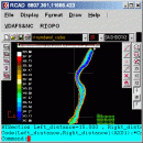
... color-filled contour maps, sections, intersections, volume, editing XYZ files, simulation of rainwater runoff and much more. You can represent 4D points cloud and process hundreds of thousands of points or triangles, even on less powerful PCs. ...

Author Rcad Software
License Free To Try
Price $189.00
Released 2024-11-30
Downloads 1390
Filesize 2.49 MB
Requirements Graphic card with OpenGL hardware acceleration and 32-bit color depth
Installation Install and Uninstall
Keywords CAD for Topography, hydrology, LandXML, Triangulation, Isolines, Cross sections
Users' rating
(7 rating)
RTOPO HydrologyCADWin2000, Windows XP, Windows 7 x32, Windows 7 x64, Windows 8, Windows 10, WinServer, WinOther, Windows 2000, Windows 2003, Windows Server 2000, Windows Server 2003, Windows Server 2008, Windows Server 2008r2, Windows Server 2012, Windows Tablet PC Edition 2005, Windows Media Center Editi
RTOPO Hydrology map files - Download Notice

Using RTOPO Hydrology Free Download crack, warez, password, serial numbers, torrent, keygen, registration codes, key generators is illegal and your business could subject you to lawsuits and leave your operating systems without patches. We do not host any torrent files or links of RTOPO Hydrology on rapidshare.com, depositfiles.com, megaupload.com etc. All RTOPO Hydrology download links are direct RTOPO Hydrology full download from publisher site or their selected mirrors.
Avoid: map files oem software, old version, warez, serial, torrent, RTOPO Hydrology keygen, crack.
Consider: RTOPO Hydrology full version, map files full download, premium download, licensed copy.

RTOPO Hydrology map files - The Latest User Reviews

Most popular CAD downloads

RTOPO Hydrology

3.4Half download

... modifiable library of codes -edit interactively the XYZ files of points; you can modify the coordinates, the ... more interior contours -contour lines and color-filled contour map -cross sections and longitudinal profile -the projection of ...

Multiwfn

3.7 download

... Outputting properties in a line and plotting curve map. ยท Outputting properties in a plane and plotting graph. Supported graph types including filled-color map, contour map, relief map (with/without projection), gradient map, ...

TRIANGULATION for IntelliCAD

3.9d download

TRIANGULATION, ISOLINES, VOLUME, LOADING of XYZ points files, 3DINTERSECTION, cross sections and a longitudinal profile, color-filled contour map; 7 functions for IntelliCAD versions which can load ... contain arcs. You can also make color-filled contour map. The price is for the first license! You ...

TRIANGULATION for AutoCAD

2.3 download

... Y Z Code. The drawing of the XYZ files is made with POINT, 3DPOLY, SPLINE or BLOCK entities, according to a modifiable library of codes. The triangulation is performed on ...

TransLT

15.0 download

... data can be imported from txt or csv files, and it allows saving the modification for each ... operations: * coordinates conversions (including using a map projection); * polynomial transformations; * transformations using grid ...

LabCollector

4.96 download

... easily. No more paper records or loose excel files! Built around independent modules that can interact ... easily. No more paper records or loose excel files! Modules & Functions * Strains&Cells Module ...

Picard

2.27.2 download

Picard comprises Java-based command-line utilities that manipulate SAM files, and a Java API (SAM-JDK) for creating new programs that read and write SAM files. Both SAM text format and SAM binary (BAM) ...

GetNexrad

4.4.2 download

... neighbor sites. Reads NOAA Weather Toolkit historical KMZ files and 0.5 dBZ long range higher resolution images. Goggle Map overlays, real-time surface observations, and a web browser ...

CARIS Easy View

4.2.13 download

... view spatial data imported from numerous types of files. It allows you to load multiple layers, change ... record fly-throughs and export the recordings as movie files. It is important for a geographical data ...

PDF to DWG Converter (Developer License)

2.0 download

... Converter can be used to batch convert PDF files to DWG or DXF files, it is a stand-alone program that needn't of ... powerful program will help you convert your PDF files to usable and editable DWG or DXF files ...