TNTmips for Mac OS X 20240111

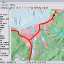
TNTmips is a geospatial image processing tool that allows you to analyze and modify GIS images. It is a professional application that can handle desktop cartography, electronic atlas preparation and spatial database management. ...

Author MicroImages, Inc.
License Freeware
Price FREE
Released 2024-01-11
Downloads 241
Filesize 87.90 MB
Requirements Mac (OS 10.8 to 11), XQuartz 2.7.9 needed (2.7.11 with manual modification)
Installation Instal And Uninstall
Keywords GIS data analysis, analyze geodetic data, edit GIS dataset, GIS, dataset, editor, analysis, mac os, TNTmips for mac, TNTgis for mac, TNTedit
Users' rating
(45 rating)
TNTmips for Mac OS XCADMac OS X
TNTmips for Mac OS X map software - Download Notice

Using TNTmips for Mac OS X Free Download crack, warez, password, serial numbers, torrent, keygen, registration codes, key generators is illegal and your business could subject you to lawsuits and leave your operating systems without patches. We do not host any torrent files or links of TNTmips for Mac OS X on rapidshare.com, depositfiles.com, megaupload.com etc. All TNTmips for Mac OS X download links are direct TNTmips for Mac OS X full download from publisher site or their selected mirrors.
Avoid: map software oem software, old version, warez, serial, torrent, TNTmips for Mac OS X keygen, crack.
Consider: TNTmips for Mac OS X full version, map software full download, premium download, licensed copy.

TNTmips for Mac OS X map software - The Latest User Reviews

Most popular CAD downloads

SoundStepper

5.4.1.304 download

SoundStepper is a 100% software telescope controller, for Windows. Using audio hardware to ... telescope control, such as for example a sky map, autoguiding, or capture images from a webcam or

GEOPoint

5.1 download

... coordinates directly, or by clicking on a world map; select earth station location from a built-in list ... satellite azimuth and elevation contours on the world map to aid in site selection; entry of latitude ...

5 award

Mobile Atlas Creator for Mac OS X

2.2.1 download

... exported as one large PNG image with calibration MAP file for OziExplorer. As source for an offline ... OpenStreetMap, Google Maps, Yahoo Maps and other online map providers. Features: Create offline atlases for ...

UCL Depthmap

0.8.0 download

Depthmap is a single software platform to perform a set of spatial network ... states. At each scale, the aim of the software is to produce a map of open space elements, connect them via some ...

Elshayal Smart

23.02 download

Elshayal Smart is the first Arabian GIS software that is completely developed by Arabian developers team and independent of any commercial software package. Download Maps from Google Earth, and ... query builder, build network, find shortest path, print map, save map image, copy map image to clipboard, ...

TNTmips for Mac OS X

20240111 download

... of geospatial data including imagery, terrain surfaces, and map data with associated database attributes. It provides all ... published on the Internet as web tilesets, Web Map Service (WMS), and ArcIMS. Automatically generate hundreds ...

Mobile Atlas Creator

2.2.1 download

... exported as one large PNG image with calibration MAP file for OziExplorer. As source for an offline ... OpenStreetMap, Google Maps, Yahoo Maps and other online map providers. Features: Create offline atlases for ...

Thuban for Windows

1.2.2 download

... Data Support: GeoTIFF Layer and GDAL # Comfortable Map Navigation # Object Identification and Annotation # Legend ... The FreeGIS Project provides an overview of Free Software GIS projects. Many valuable and highly sophisticated tools ...

Thuban for Mac OS X

1.0.1-3 download

... Data Support: GeoTIFF Layer and GDAL # Comfortable Map Navigation # Object Identification and Annotation # Legend ... The FreeGIS Project provides an overview of Free Software GIS projects. Many valuable and highly sophisticated tools ...

Thuban for Linux

1.2.2 download

... Data Support: GeoTIFF Layer and GDAL # Comfortable Map Navigation # Object Identification and Annotation # Legend ... The FreeGIS Project provides an overview of Free Software GIS projects. Many valuable and highly sophisticated tools ...