Metes and Bounds 6.2.2

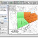
Enter measurements in rods, chains, meters, yards, inches, fathoms, hands, spans or furlongs. Angles can be given down to minutes and seconds. Can auto-close a plot drawing if the final plot segment is missing. Calculate area. Custom labels and backgrounds. Split single plots into multiple plots. GPS Waypoints and more. ...

Author Sandyknoll Software
License Trialware
Price $39.95
Released 2024-06-10
Downloads 997
Filesize 34.60 MB
Requirements
Installation Instal And Uninstall
Keywords plot map, calculate square feet, calculate acreage, calculator, acreage, perimeter
Users' rating
(29 rating)
Metes and BoundsCADWindows 7, Windows 7 x64, Windows 8, Windows 8 x64, Windows 10, Windows 10 x64, Windows 11
Metes and Bounds map - Download Notice

Using Metes and Bounds Free Download crack, warez, password, serial numbers, torrent, keygen, registration codes, key generators is illegal and your business could subject you to lawsuits and leave your operating systems without patches. We do not host any torrent files or links of Metes and Bounds on rapidshare.com, depositfiles.com, megaupload.com etc. All Metes and Bounds download links are direct Metes and Bounds full download from publisher site or their selected mirrors.
Avoid: map oem software, old version, warez, serial, torrent, Metes and Bounds keygen, crack.
Consider: Metes and Bounds full version, map full download, premium download, licensed copy.

Metes and Bounds map - The Latest User Reviews

Most popular CAD downloads

TNTmips

20240404 download

... of geospatial data including imagery, terrain surfaces, and map data with associated database attributes. It provides all ... published on the Internet as web tilesets, Web Map Service (WMS), and ArcIMS ... Automatically generate ...

QFitsView

3.1 Revision 741 download

... files. The user can change the color map and the scale user for rendering the image in order to emphasize certain elements. ...

Metes and Bounds

6.2.2 download

... and Bounds turns data into a deed plot map. It can calculate square feet, acreage and hectares. Enter measurements in rods, chains, meters, yards, inches, fathoms, hands, spans ...

TransLT

15.0 download

... operations: * coordinates conversions (including using a map projection); * polynomial transformations; * transformations using grid files (files containing corrections values); * transformations with parameters: 1D, 2D or 3D; ...

MagicPlot Student

2.9.3 download

... - Data processing - Multiple axes - Color map plots - Figure templates - Batch processing ...

UCL Depthmap

0.8.0 download

... aim of the software is to produce a map of open space elements, connect them via some ... Depthmap can be used to derive an ‘axial map’ of a layout. That is, derive a reduced ...

GEOPoint

5.1 download

... coordinates directly, or by clicking on a world map; select earth station location from a built-in list ... satellite azimuth and elevation contours on the world map to aid in site selection; entry of latitude ...

5 award

Thuban for Windows

1.2.2 download

... Data Support: GeoTIFF Layer and GDAL # Comfortable Map Navigation # Object Identification and Annotation # Legend ... falls into five major parts: * Map * Legend * Statusbar * Toolbar and * ...

SWLibrary

1.2.0 download

Create 3D contour surface. The library with source code. ...

AutoCAD LT

2023 download

... paper or create PDFs that include the geolocation map. Professional documentation tools Capture the precise details of your design with AutoCAD documentation tools. Import models from a ...