OpenCPN 5.10.2

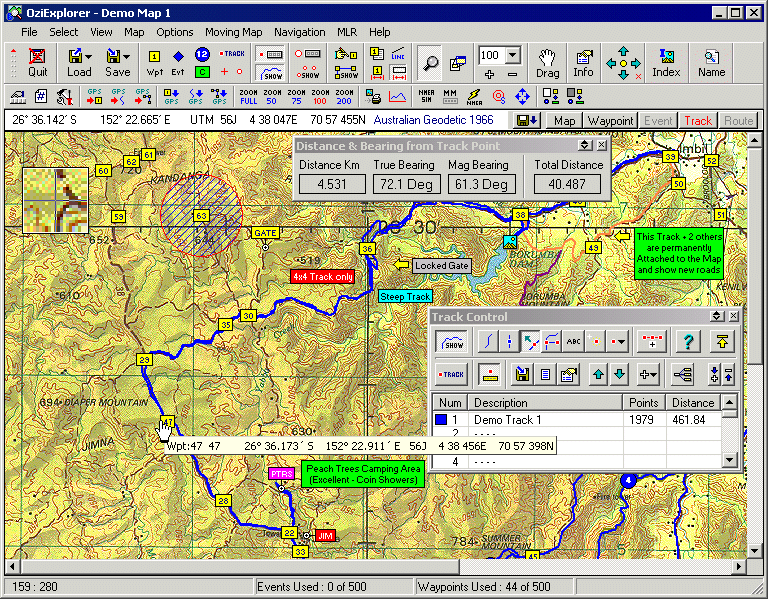
OpenCPN is a powerful, open-source chart plotting software designed for sailors and marine enthusiasts. Developed by The OpenCPN Authors, it offers a user-friendly interface that supports a wide range of chart formats, including raster and vector charts. With features like real-time GPS tracking, route planning, and customizable plugins, OpenCPN enhances navigation safety and efficiency. Its active community ensures continuous updates and support, making it an essential tool for both novice and ... ...

Author The OpenCPN Authors
License Open Source
Price FREE
Released 2024-09-12
Downloads 16
Filesize 36.40 MB
Requirements
Installation
Keywords OpenCPN, download OpenCPN, OpenCPN free download, chart plotter, chart navigator, Chart Plotter Navigation, map, navigator, sail, plotter
Users' rating
(10 rating)
OpenCPNOtherWindows 11, Windows 10 32/64 bit, Windows 8 32/64 bit, Windows 7 32/64 bit, Windows Vista, Windows XP 32/64 bit
OpenCPN map - Download Notice

Using OpenCPN Free Download crack, warez, password, serial numbers, torrent, keygen, registration codes, key generators is illegal and your business could subject you to lawsuits and leave your operating systems without patches. We do not host any torrent files or links of OpenCPN on rapidshare.com, depositfiles.com, megaupload.com etc. All OpenCPN download links are direct OpenCPN full download from publisher site or their selected mirrors.
Avoid: map oem software, old version, warez, serial, torrent, OpenCPN keygen, crack.
Consider: OpenCPN full version, map full download, premium download, licensed copy.

OpenCPN map - The Latest User Reviews

Most popular Other downloads

TomTom Home

2.24.11.8 download

... area by offering easy access to the latest map updates. Users can download new maps or update ... reach their destinations efficiently. In addition to map updates, TomTom HOME offers a range of customization ...

ExpertGPS

9.14 download

... the standout features of ExpertGPS is its extensive map library. Users have access to high-resolution aerial imagery, ... the software to their specific needs. From customizing map symbols and labels to creating personalized templates for ...

Desktop Projector

3.4.4 download

... software tool designed to transform and visualize global map projections. This innovative application caters to a broad ... intuitive platform for exploring the world through various map projections. At its core, G.Projector excels in ...

ediTrail

1.0 download

... with inheritance of data, attributes, etc. Presentation on map: View on map in accordance with the active trail, which comes ... mode (photos, orthophotos, etc), as 'Map' mode, (Topographic map, street maps, etc). Digital Terrain Model, DTM: I ...

Google Earth for Mac OS X

7.3.6.10155 download

Google Earth Pro, developed by Google, is a robust and versatile geographical exploration tool that brings the world to your fingertips with remarkable precision and detail. Originally designed for professional use, ...

Panoply

5.6.0 download

Panoply, developed by Robert B. Schmunk, is a sophisticated data visualization tool designed to cater to the needs of scientists, researchers, and data enthusiasts who work extensively with multidimensional datasets. This ...

WinCoot

1.1.14 download

... decisions during the modeling process. 2. **Density Map Visualization**: One of WinCoot's standout features is its exceptional density map visualization capabilities. The software allows users to seamlessly ...

Easy OpenstreetMap Downloader

6.620 download

... cartography enthusiasts, GIS professionals, and anyone requiring detailed map data for offline use. This tool stands out ... then be stitched together to form a comprehensive map. The software supports a variety of zoom levels, ...

OpenCPN

5.10.2 download

OpenCPN, developed by The OpenCPN Authors, is a robust and versatile open-source chart plotting and navigation software designed to meet the needs of both amateur and professional mariners. This powerful tool ...

Google Earth images downloader

6.440 download

... entering coordinates or selecting a region on the map. The tool then downloads the images within the specified boundaries, ensuring that users receive the exact data they need. One ...