ediTrail 1.0

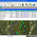
You can manage unlimited trails/routes on a simple and flexible table where you can export and import from GPS files, (gpx format). You can manage/view on table all the taken photographs in each trail/waypoint. Each trail/route can be edited over the map with vectorial CAD tools to create, move, split, join, invert trails and trackpoints, (trail vertices). ediTrail works in desktop mode and into CAD systems, (Autocad/Bricscad/Zwcad). ...

Author Aplicaciones Topográficas S.L.
License Freeware
Price FREE
Released 2014-11-07
Downloads 193
Filesize 27.05 MB
Requirements Desktop application, MIcrosoft operating systems, 32&64 bits
Installation Install and Uninstall
Keywords Trail, Route, GPS, gpx, geographical, latitude, longitude, utm, elevation, photo, Track, Way Point, Track Point, hiking, biking, cycling, map, land, terrain, surveying, DTM, D.T.M., digital terrain model, AutoCAD, BricsCAD, CAD, draw, points cloud, contouring, triangulation
Users' rating
(6 rating)
ediTrailOtherWin2000, Windows XP, Windows 7 x32, Windows 7 x64, Windows 8, WinServer, Windows Vista, Windows Vista x64
ediTrail maps - Download Notice

Using ediTrail Free Download crack, warez, password, serial numbers, torrent, keygen, registration codes, key generators is illegal and your business could subject you to lawsuits and leave your operating systems without patches. We do not host any torrent files or links of ediTrail on rapidshare.com, depositfiles.com, megaupload.com etc. All ediTrail download links are direct ediTrail full download from publisher site or their selected mirrors.
Avoid: maps oem software, old version, warez, serial, torrent, ediTrail keygen, crack.
Consider: ediTrail full version, maps full download, premium download, licensed copy.

ediTrail maps - The Latest User Reviews

Most popular Other downloads

WinStars

3.0.304 (2025 download

... stars, thousands of deep-sky objects, and detailed planetary maps. This wealth of information is presented through a user-friendly interface that makes navigation intuitive and engaging. One of the standout ...

WriteMapper

4.4.3 download

... tools and platforms. Users can export their mind maps into various formats, including Markdown, HTML, and Microsoft Word, ensuring compatibility with their preferred writing and publishing tools. Another notable ...

ChroMapper

0.11.793 download

... designed for the creation and editing of custom maps for rhythm games. This tool stands out in ... This allows mappers to create intricate and challenging maps that are perfectly synchronized with the music. The ...

ExpertGPS

9.05 download

... Users have access to high-resolution aerial imagery, topographic maps, and street maps, ensuring they have the most accurate and up-to-date ... their fingertips. The software supports both USGS topo maps and seamless aerial photos, which can be invaluable ...

ediTrail

1.0 download

... the active trail, which comes from providers of maps, as in 'Satellite' mode (photos, orthophotos, etc), as 'Map' mode, (Topographic map, street maps, etc). Digital Terrain Model, DTM: I have downloaded ...

Google Maps Downloader

8.874 download

**Google Maps Downloader by Allmapsoft: A Comprehensive Tool for Offline Map Enthusiasts** Google Maps Downloader, developed by Allmapsoft, is a specialized software ... for users who need to download and save maps from Google Maps for offline use. This tool ...

QFitsView

8.6 download

... experience with a variety of scaling options, color maps, and region definitions, enabling precise control over how data is presented. This flexibility is crucial for identifying subtle features in astronomical ...

Maps Travel Album Creator

2.01 download

... seamless way to create personalized travel albums using maps as the central theme, providing a fresh perspective ... documenting travel experiences. The core functionality of Maps Travel Album Creator revolves around its ability to ...

Panoply

5.5.5 download

... effortlessly create a variety of plots, including latitude-longitude maps, zonal averages, time series, and scatter plots. The software's intuitive interface allows for seamless navigation and manipulation of data, enabling users ...

WinCoot

1.1.11 download

... software allows users to seamlessly integrate electron density maps, facilitating the identification of structural anomalies and the validation of model accuracy. The high-resolution display ensures that even the smallest details ...