- Software
- - Graphic Apps
- - CAD
- - GeoMapApp
GeoMapApp 3.7.1
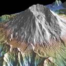
This powerful program provides direct access to the Global Multi-Resolution Topography (GMRT) compilation. The database hosts high resolution (~100 m node spacing) bathymetry from multibeam data for ocean areas and ASTER (Advanced Spaceborne Thermal Emission and Reflection Radiometer) and NED (National Elevation Dataset) topography datasets for the global land masses. ...
| Author | William Haxby |
| License | Freeware |
| Price | FREE |
| Released | 2023-08-15 |
| Downloads | 72 |
| Filesize | 78.00 MB |
| Requirements | Java 8 |
| Installation | Instal And Uninstall |
| Keywords | geological map, geologic exploration, explore map, explore, geologic, map |
| Users' rating (5 rating) |
Using GeoMapApp Free Download crack, warez, password, serial numbers, torrent, keygen, registration codes,
key generators is illegal and your business could subject you to lawsuits and leave your operating systems without patches.
We do not host any torrent files or links of GeoMapApp on rapidshare.com, depositfiles.com, megaupload.com etc.
All GeoMapApp download links are direct GeoMapApp full download from publisher site or their selected mirrors.
Avoid: marine software oem software, old version, warez, serial, torrent, GeoMapApp keygen, crack.
Consider: GeoMapApp full version, marine software full download, premium download, licensed copy.


