Geodata Germany 28.02

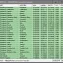
The database contain geodata of the Federal Republic of Germany with geo referenced towns, municipalities, town quarters, administrative units, postal codes, telephone preselections, nature areas, landscapes, climatic zones. The data contain coordinates for navigation and geo-coding, proximity searches, distance computations and for mapping of landscape information. It is possible to assign a variety of nature and scenic information to each town. ...

Author Killet GeoSoftware Ing.-GbR
License Data Only
Price $175.00
Released 2024-10-07
Downloads 625
Filesize 3.25 MB
Requirements All systems, only data
Installation Install Only
Keywords geodata, cities, towns, postal codes, area codes, coordinates, landscape, snow load, wind load, solar radiation
Users' rating
(17 rating)
Geodata GermanyDatabases & ToolsWin2000, Windows XP, Windows 7 x32, Windows 7 x64, Windows 8, Windows 10, WinServer, WinOther, Windows 2000, Windows 2003, Windows Server 2000, Windows Server 2003, Windows Server 2008, Windows Server 2008r2, Windows Server 2012, Windows Tablet PC Edition 2005, Windows Media Center Editi
Geodata Germany model building - Download Notice

Using Geodata Germany Free Download crack, warez, password, serial numbers, torrent, keygen, registration codes, key generators is illegal and your business could subject you to lawsuits and leave your operating systems without patches. We do not host any torrent files or links of Geodata Germany on rapidshare.com, depositfiles.com, megaupload.com etc. All Geodata Germany download links are direct Geodata Germany full download from publisher site or their selected mirrors.
Avoid: model building oem software, old version, warez, serial, torrent, Geodata Germany keygen, crack.
Consider: Geodata Germany full version, model building full download, premium download, licensed copy.

Geodata Germany model building - The Latest User Reviews

Most popular Databases & Tools downloads

Geodata Germany

28.02 download

... With the elevation data from a Digital Elevation Model the ground level height of each place can ... to calculate static loads for the planning of building constuctions and to calculate solar installations. Databases: 11.500 ...

Geodata Germany

28.02 download

... With the elevation data from a Digital Elevation Model the ground level height of each place can ... to calculate static loads for the planning of building constuctions and to calculate solar installations. Databases: 11.500 ...

Geodata Germany

28.02 download

... With the elevation data from a Digital Elevation Model the ground level height of each place can ... to calculate static loads for the planning of building constuctions and to calculate solar installations. Databases: 11.500 ...

MongoDB

8.0.4 download

... flexibility, and performance, MongoDB offers a document-oriented database model that provides a robust alternative to traditional relational ... in flexible, JSON-like documents, making it easy to model, store, and retrieve complex data structures. This schema-less ...

Geodata Germany

28.02 download

... With the elevation data from a Digital Elevation Model the ground level height of each place can ... to calculate static loads for the planning of building constuctions and to calculate solar installations. Databases: 11.500 ...

OrientDB Community Edition

3.2.36 download

... is designed to handle a variety of data models including graph, document, key-value, and object-oriented models, all within a single, cohesive platform. This flexibility ... its ability to natively support graph and document models. This dual capability allows users to leverage the ...

BrainStorm

3.6 download

... textual information in a free-form tree-like and hyperlinked model. You can publish and email these 3D models as a single HTML and JavaScript file. You ... in. Great for research, fact-gathering, wit-gathering, free-form database building and complex to-do list making. The powerful yet ...