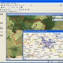
Dr. Regener LandMap Vivo 10
Create own true to scale maps, store online maps locally with Vivo techology, map editor, dataexchange with Google Earth by Copy and Paste, GPS enabled coordinates, area calculation, import of free OpenStreatMap data and GPS Exchange and GPS logger data, compatible with "GPS for Google Earth", print true to scale with and without satellite background, export as pixel file and kmz, ...
| Author | GPSsur Dr. Erhard Regener |
| License | Free To Try |
| Price | $65.00 |
| Released | 2009-01-08 |
| Downloads | 310 |
| Filesize | 6.36 MB |
| Requirements | |
| Installation | Install and Uninstall |
| Keywords | Map, geodata, wgs84, aereal photo, orthophoto, GPS, openstreetmap, google earth, virtual earth, roadmap, landmap, satellite, kml, kmz, onlinemaps, GPX |
| Users' rating (8 rating) |
Using Dr. Regener LandMap Vivo Free Download crack, warez, password, serial numbers, torrent, keygen, registration codes,
key generators is illegal and your business could subject you to lawsuits and leave your operating systems without patches.
We do not host any torrent files or links of Dr. Regener LandMap Vivo on rapidshare.com, depositfiles.com, megaupload.com etc.
All Dr. Regener LandMap Vivo download links are direct Dr. Regener LandMap Vivo full download from publisher site or their selected mirrors.
Avoid: orthophoto oem software, old version, warez, serial, torrent, Dr. Regener LandMap Vivo keygen, crack.
Consider: Dr. Regener LandMap Vivo full version, orthophoto full download, premium download, licensed copy.


