Metes and Bounds 6.2.4

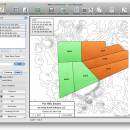
... down to minutes and seconds. Can auto-close a plot drawing if the final plot segment is missing. Calculate area. Custom labels and backgrounds. Split single plots into multiple plots. GPS Waypoints and more. ...

Author Sandy Knoll Software
License Demo
Price FREE
Released 2024-12-04
Downloads 1002
Filesize 35.50 MB
Requirements
Installation Instal And Uninstall
Keywords plot map, calculate square feet, calculate acreage, calculator, acreage, perimeter
Users' rating
(30 rating)
Metes and BoundsOtherWindows 11, Windows 10 32/64 bit, Windows 8 32/64 bit, Windows 7 32/64 bit
Metes and Bounds plot map - Download Notice

Using Metes and Bounds Free Download crack, warez, password, serial numbers, torrent, keygen, registration codes, key generators is illegal and your business could subject you to lawsuits and leave your operating systems without patches. We do not host any torrent files or links of Metes and Bounds on rapidshare.com, depositfiles.com, megaupload.com etc. All Metes and Bounds download links are direct Metes and Bounds full download from publisher site or their selected mirrors.
Avoid: plot map oem software, old version, warez, serial, torrent, Metes and Bounds keygen, crack.
Consider: Metes and Bounds full version, plot map full download, premium download, licensed copy.

Metes and Bounds plot map - The Latest User Reviews

Most popular Other downloads

Panoply

5.5.5 download

... data. Users can effortlessly create a variety of plots, including latitude-longitude maps, zonal averages, time series, and scatter plots. The software's intuitive interface allows for seamless navigation ... numerous datasets. Additionally, it offers extensive options for plotting and customization, allowing users to tailor visualizations to ...

Metes and Bounds

6.2.4 download

... and Bounds is a software that can create plot maps, perform calculations in square feets, acres, hectares, ... Metes and Bounds turns data into a deed plot map. It can calculate square feet, acreage and ...

ShipPlotter

12.5.5.9 download

... intuitive interface displays this data on a dynamic map, allowing users to easily visualize the positions and ... and user-friendly. The software supports a range of map formats, including raster charts and satellite imagery, providing ...

OpenCPN

5.10.2 download

... Authors, is a robust and versatile open-source chart plotting and navigation software designed to meet the needs ... route planning and waypoint management, enabling users to plot courses with precision. The software allows for the ...