- Software
- - Home & Hobby
- - Other
- - ediTrail
ediTrail 1.0
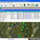
You can manage unlimited trails/routes on a simple and flexible table where you can export and import from GPS files, (gpx format). You can manage/view on table all the taken photographs in each trail/waypoint. Each trail/route can be edited over the map with vectorial CAD tools to create, move, split, join, invert trails and trackpoints, (trail vertices). ediTrail works in desktop mode and into CAD systems, (Autocad/Bricscad/Zwcad). ...
| Author | Aplicaciones Topográficas S.L. |
| License | Freeware |
| Price | FREE |
| Released | 2014-11-07 |
| Downloads | 203 |
| Filesize | 27.05 MB |
| Requirements | Desktop application, MIcrosoft operating systems, 32&64 bits |
| Installation | Install and Uninstall |
| Keywords | Trail, Route, GPS, gpx, geographical, latitude, longitude, utm, elevation, photo, Track, Way Point, Track Point, hiking, biking, cycling, map, land, terrain, surveying, DTM, D.T.M., digital terrain model, AutoCAD, BricsCAD, CAD, draw, points cloud, contouring, triangulation |
| Users' rating (10 rating) |
Using ediTrail Free Download crack, warez, password, serial numbers, torrent, keygen, registration codes,
key generators is illegal and your business could subject you to lawsuits and leave your operating systems without patches.
We do not host any torrent files or links of ediTrail on rapidshare.com, depositfiles.com, megaupload.com etc.
All ediTrail download links are direct ediTrail full download from publisher site or their selected mirrors.
Avoid: point data oem software, old version, warez, serial, torrent, ediTrail keygen, crack.
Consider: ediTrail full version, point data full download, premium download, licensed copy.


