FlashPoints 3.0

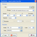
FlashPoints is a tool for creating and managing points Groups (topographic points for example). FlashPoints allows you to : * import/export points coordinates from and to a file * create points and their attributes 'Number', 'Elevation' and 'Description' by clicking * modify the points elevation * modify the height and rotation of the attributes * create points on existing entities * create the table of ...

Author DeliCAD
License Demo
Price $70.00
Released 2016-02-18
Downloads 121
Filesize 3.94 MB
Requirements
Installation Install and Uninstall
Keywords autocad, cad, dxf, xls, excel, gps, xyz, nxyz, points, import, cogo, survey, coordinates, gis, topography
Users' rating
(4 rating)
FlashPointsCADWin2000, Windows XP, Windows 7 x32, Windows 7 x64, Windows 8, Windows 10, WinServer, WinOther, Windows Vista, Windows Vista x64
FlashPoints points - Download Notice

Using FlashPoints Free Download crack, warez, password, serial numbers, torrent, keygen, registration codes, key generators is illegal and your business could subject you to lawsuits and leave your operating systems without patches. We do not host any torrent files or links of FlashPoints on rapidshare.com, depositfiles.com, megaupload.com etc. All FlashPoints download links are direct FlashPoints full download from publisher site or their selected mirrors.
Avoid: points oem software, old version, warez, serial, torrent, FlashPoints keygen, crack.
Consider: FlashPoints full version, points full download, premium download, licensed copy.

FlashPoints points - The Latest User Reviews

Most popular CAD downloads

FlashMNT for AutoCAD and BricsCAD

6.11 download

... a Digital Terrain Model and 3D computations. From points and/or breaklines, create a DTM, then use the various fonctions of FlashMNT to apply a mesh, color a DTM by altitudes, ...

PDF to DWG Converter (Developer License)

2.0 download

... support option to use mm coordinates instead of points in DWG or DXF files; 10. VeryDOC PDF to DWG Converter support map colors to layers in CAD drawing; 11. VeryDOC ...

GGCad

2.1.0.5 download

... be able to draw different shapes such as points, lines, circles, arcs, ellipses, text and splines. Moreover, you will have the transformation tools such as rotation, symmetry, scale, translation. Spur ...

BricsCad Classic

24.2.06-1 download

... BricsCad, Dimensions can be linked to entity snap points such as endpoints, midpoints and perpendicular. Associative dimensioning applies to both linear and angular dimensions. Layer states let you save ...

GreatCirc

4.2 download

... calculate great circle distances and bearings between two points on the globe. This is essential for anyone involved in aviation or maritime navigation, as it provides the shortest path over ...

5 award

Automesher 64-bit

2.4.8 download

... mesh, polygon mesh, solid, 3D faces, lines and points. ...

Multiwfn

3.7 download

... analysis for electron density, ELF/LOL, laplacian etc. Critical points and gradient paths can be searched and visualized in terms of 3D or plane graph. Interbasin · surfaces can be drawn. ...

GstarCAD MC

3.3.1 download

... the number of the coordinates to move the points precisely. • Support 2D absolute coordinates, relative coordinates and polar coordinates and 3D Spherical coordinates and Cylindrical coordinates. • Draw Line, ...

TopoLT

15.2 download

... cadastre projects. FEATURES: · draws directly points from coordinate files, draws coordinates from total station ... codes interpretation file defined by the user; · points can be graphically drawn with or without elevations, ...

GC-PrevuePlus

21.2 download

... a measure tool to find distances between data points, ability to fix polygon data errors commonly found in DXF and DWG files, drill drawing creation, streamlined data translation between various ...