- Software
- - Graphic Apps
- - Editors
- - WinTopo
WinTopo 1.752
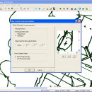
WinTopo is an application for converting TIF, JPG, PNG, GIF, BMP files and scanned images into useful vector files suitable for CAD, GIS and CNC applications. The freeware version is completely free for everyone to use. This is a highly capable piece of software which produces better results than most expensive commercial alternatives. Over a million users worldwide have already taken advantage of this powerful converter. ...
| Author | SoftSoft |
| License | Freeware |
| Price | FREE |
| Released | 2013-04-18 |
| Downloads | 197 |
| Filesize | 2.49 MB |
| Requirements | |
| Installation | Instal And Uninstall |
| Keywords | map, graphic, editor, vector, file, cad |
| Users' rating (8 rating) |
Using WinTopo Free Download crack, warez, password, serial numbers, torrent, keygen, registration codes,
key generators is illegal and your business could subject you to lawsuits and leave your operating systems without patches.
We do not host any torrent files or links of WinTopo on rapidshare.com, depositfiles.com, megaupload.com etc.
All WinTopo download links are direct WinTopo full download from publisher site or their selected mirrors.
Avoid: raster map oem software, old version, warez, serial, torrent, WinTopo keygen, crack.
Consider: WinTopo full version, raster map full download, premium download, licensed copy.


