R2V 3.66

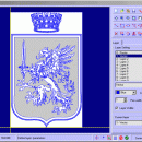
R2V convert raster images to vector by drawing centerlines and outlines. ... drawing program. R2V supports the Bmp and Jpeg raster format. The output vector files can be saved in DXF, HPGL and TXT format. R2V also converts any True Type font into vector. ...

Author MR Soft
License Free To Try
Price $42.00
Released 2020-01-24
Downloads 2133
Filesize 1.69 MB
Requirements Pentium/Amd >300 MHz, True color Video Card (24-bit) - 800 x 600
Installation Install and Uninstall
Keywords vector, r2v, vectorize, cnc, photo, engraving, bmp, hobby, carving, mill, cad, cam, stl, image, hpgl, dxf, raster, grayscale, conversion, g-code
Users' rating
(12 rating)
R2VCADWin2000, Windows 7 x32, WinOther, Windows Vista, Windows XP, Other
R2V raster maps - Download Notice

Using R2V Free Download crack, warez, password, serial numbers, torrent, keygen, registration codes, key generators is illegal and your business could subject you to lawsuits and leave your operating systems without patches. We do not host any torrent files or links of R2V on rapidshare.com, depositfiles.com, megaupload.com etc. All R2V download links are direct R2V full download from publisher site or their selected mirrors.
Avoid: raster maps oem software, old version, warez, serial, torrent, R2V keygen, crack.
Consider: R2V full version, raster maps full download, premium download, licensed copy.

R2V raster maps - The Latest User Reviews

Most popular CAD downloads

R2V

3.66 download

R2V is a tool for converting raster images to vector by drawing centerlines and outlines. R2V converts architect, mechanical and various technical drawings, maps and other types from raster to vector format. ...

Panoply for Mac

5.4.3 download

... can project the analysis using more than 100 maps. What’s more, you get to overlay continent, or other types of masks on top of the generated arrays. You ...

Elshayal Smart

23.02 download

... independent of any commercial software package. Download Maps from Google Earth, and Trace & save GPS route and View and Rectify Raster Images gif, jpg, bmp and Edit shape files, ...

TNTmips

20240404 download

... formats without importing. Overlay your geodata on Bing Maps imagery and maps or on geodata layers published on the Internet ... Import and export an unsurpassed number of raster, geometric, and database file formats; convert between data ...

CARIS Easy View

4.2.13 download

... control of the data. Users can load multiple raster, point cloud and vector data sources, change the ... types of files, as various GIS applications save maps and models to a wide array of formats. ...

MapInfo Professional

17.0.4 download

... data and creating detailed, yet intelligible graphical representations, maps and reports. Location adds complexity to many decisions, ... for web mapping applications and create presentation quality maps in a familiar environment that combines data analysis, ...

TNTmips for Mac OS X

20240111 download

... formats without importing. Overlay your geodata on Bing Maps imagery and maps or on geodata layers published on the Internet ... Import and export an unsurpassed number of raster, geometric, and database file formats; convert between data ...