ediTrail 1.0

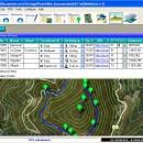
You can manage unlimited trails/routes on a simple and flexible table where you can export and import from GPS files, (gpx format). You can manage/view on table all the taken photographs in each trail/waypoint. Each trail/route can be edited over the map with vectorial CAD tools to create, move, split, join, invert trails and trackpoints, (trail vertices). ediTrail works in desktop mode and into CAD systems, (Autocad/Bricscad/Zwcad). ...

Author Aplicaciones Topográficas S.L.
License Freeware
Price FREE
Released 2014-11-07
Downloads 197
Filesize 27.05 MB
Requirements Desktop application, MIcrosoft operating systems, 32&64 bits
Installation Install and Uninstall
Keywords Trail, Route, GPS, gpx, geographical, latitude, longitude, utm, elevation, photo, Track, Way Point, Track Point, hiking, biking, cycling, map, land, terrain, surveying, DTM, D.T.M., digital terrain model, AutoCAD, BricsCAD, CAD, draw, points cloud, contouring, triangulation
Users' rating
(7 rating)
ediTrailOtherWin2000, Windows XP, Windows 7 x32, Windows 7 x64, Windows 8, WinServer, Windows Vista, Windows Vista x64
ediTrail route maps - Download Notice

Using ediTrail Free Download crack, warez, password, serial numbers, torrent, keygen, registration codes, key generators is illegal and your business could subject you to lawsuits and leave your operating systems without patches. We do not host any torrent files or links of ediTrail on rapidshare.com, depositfiles.com, megaupload.com etc. All ediTrail download links are direct ediTrail full download from publisher site or their selected mirrors.
Avoid: route maps oem software, old version, warez, serial, torrent, ediTrail keygen, crack.
Consider: ediTrail full version, route maps full download, premium download, licensed copy.

ediTrail route maps - The Latest User Reviews

Most popular Other downloads

Windows Maps

11.2411.7.0 download

Windows Maps, developed by Microsoft, is a versatile navigation and ... and avid travelers. At its core, Windows Maps provides detailed and up-to-date maps that cover a wide range of global locations. ...

ediTrail

1.0 download

... the active trail, which comes from providers of maps, as in 'Satellite' mode (photos, orthophotos, etc), as 'Map' mode, (Topographic map, street maps, etc). Digital Terrain Model, DTM: I have downloaded ...

OziExplorer

3.95.6f download

... to work, on your computer screen, with digital maps that you have purchased or scanned yourself. By using these maps OziExplorer allows you to plan your trip by creating waypoints, routes and tracks on screen and upload these to ...

TomTom Home

2.24.11.8 download

... computer, ensuring that you can effortlessly manage your maps, software updates, and device settings. Keeping your maps up-to-date is crucial for accurate navigation, and TomTom ... the latest map updates. Users can download new maps or update existing ones with just a few ...

TomTom MyDrive Connect

4.5.0.5086 download

... device, ensuring that you always have the latest maps, software updates, and essential features to enhance your ... Users can manage their device settings, download additional maps, and access premium services such as live traffic ...

OziExplorer

3.95.6f download

... to work, on your computer screen, with digital maps that you have purchased or scanned yourself. By using these maps OziExplorer allows you to plan your trip by creating waypoints, routes and tracks on screen and upload these to ...

RouteConverter

3.1.386 download

RouteConverter, developed by Christian Pesch, is a versatile and ... an outdoor enthusiast, or a professional needing precise route planning, RouteConverter offers a robust set of features to meet your needs. At its core, RouteConverter excels in converting, editing, and displaying GPS data ...

TrailRunner

3.7.745 download

TrailRunner is a route planning software for all kinds of long distance ... you ever asked yourself how long your workout routes are and what route you should choose for this evening — then ...

GPXSee for Mac OS X

13.26 download

... supports various map sources such as OpenStreetMap, Google Maps, and custom map tiles, ensuring that users can ... shines. Users can tailor the appearance of their maps and graphs to suit their preferences, adjusting colors, ...

Automapki

2.0.6 download

... designed to revolutionize the way users interact with maps and geospatial data. This application stands out in ... The software excels in providing detailed and customizable maps, making it an ideal choice for industries ranging ...