TOPOWIN 24.04

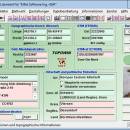
TOPOWIN is a state-wide register of the German topographic cartographies and of localities with geo references in different coordinate systems. It also is a topographic information system. The topographical maps of different standards can be determined by the entering of known parameters or by the direct selection from overview graphics and from sorted lists. ...

Author Killet GeoSoftware Ing.-GbR
License Free To Try
Price $125.00
Released 2025-02-18
Downloads 251
Filesize 4.76 MB
Requirements Pentium, 50 MB HD
Installation Install and Uninstall
Keywords topography, geodetics, geography, corner, box, coordinate, map, guide, TK25, TK50, TK50, TK100, TKUE200, GK5, DGK5, geosoftware, registers, place, topowin, topo, placelist, information, system, measuring
Users' rating
(17 rating)
TOPOWINDatabases & ToolsWin2000, Windows XP, Windows 7 x32, Windows 7 x64, Windows 8, Windows 10, WinServer, WinOther, Windows 2000, Windows 2003, Windows Server 2000, Windows Server 2003, Windows Server 2008, Windows Server 2008r2, Windows Server 2012, Windows Tablet PC Edition 2005, Windows Media Center Editi
TOPOWIN state data - Download Notice

Using TOPOWIN Free Download crack, warez, password, serial numbers, torrent, keygen, registration codes, key generators is illegal and your business could subject you to lawsuits and leave your operating systems without patches. We do not host any torrent files or links of TOPOWIN on rapidshare.com, depositfiles.com, megaupload.com etc. All TOPOWIN download links are direct TOPOWIN full download from publisher site or their selected mirrors.
Avoid: state data oem software, old version, warez, serial, torrent, TOPOWIN keygen, crack.
Consider: TOPOWIN full version, state data full download, premium download, licensed copy.

TOPOWIN state data - The Latest User Reviews

Most popular Databases & Tools downloads

DTM Data Scrubber

1.15.07 download

DTM Data Scrubber is a set of intelligent tools for data verification and scrubbing Depending on user-defined rules and data properties, the program either creates a report about the actual state of affairs or performs database data correction. The ...

ViewerFX for Crystal Reports

2.1.1.0 download

... powerful report compression and encryption to protect sensitive data, selection formula builder, post reports directly to the Web for immediate availability, third party application preview integration, and smaller installation footprint. ...

PowerShell Scripts for SQL Server

6.0 download

... objects. Initialize PowerShell SQLPS module and work with databases. Scripts for Analysis, Integration, and Reporting services. Experimental ... SQL Server 2016. New scripts for exploring In-Memory databases and query store features. Database engine: Connect to ...

Nevron Chart for SSRS

2022.1 download

... and 3D charting types, highly customizable axes, tight data integration and unmatched visual effects to your reports. It instantly improves your report authoring experience, with its polished visual editors, exhaustive ...

US Zip Code, City and State Search Database Software

7.0 download

... for users who want to search a United States database by zip code, city and state. The user can enter part of a city name, state or zip code to search and this fast ...

US Area Code Search Database Software

7.0 download

... solution to users who want to search United States area codes, city and state in a full database. The user can specify city, state or area code to search. Partial prefixes can ...

Zipkey

8.07E download

... is a complete city-level directory of 5-digit United States zipcodes, 3-digit telephone area codes, and time zones, ... manually type in the name of a United States city or town (at least not one big ...

DBF Recovery

4.46 download

... designed to restore corrupted DBF files, a common database format used by various database management systems. This software stands out for its ability to recover data from damaged DBF files with remarkable accuracy, ensuring ...

Geodata Germany

29.05 download

The database tables contains geodata of the Federal Republic of ... landscapes, climatic zones and official topographical cartographies. The data contain coordinates for navigation and geo-coding, proximity searches ... postal code or telephone preselection, to corresponding geographical data and coordinates - a Geo Reference. The geo ...

BB DOALL

6.90 download

... Pie, 3-D, opposing axis graphs, and Cross-tab. -A data converter. Import/Export spreadsheets, Mailmerge Files for MSWord. Cross-tabulation ... function to: change capitalization, replace one field with data from another, perform calculations on numeric fields, concatenate ...