LITIO 1.3.1

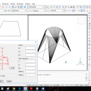
LITIO 1.3 is a sheet metal program that calculates flat (unfolded) sheet metal developments of ducts, rectangle to round transitions, cylinders, cones, pipe intersections, connections, bifurcations, elbows, etc. For HVAC, hoppers, cyclones, dust extraction, ducts, conveying systems, silos, piping, etc. To draw your sheet metal developments directly in BricsCAD & ZWCAD. ...

Author LITIO.si
License Free To Try
Price $29.88
Released 2018-08-01
Downloads 76
Filesize 1.08 MB
Requirements BricsCAD or ZWCad or AutoCAD or GStarCAD. LITIO is an addon [plugin]
Installation Install and Uninstall
Keywords sheet metal, sheet, metal, square to round, rectangle to round, AutoCAD, GStarCAD, BricsCAD, ZWCad, hvac, parametric, development, transition, unfold, unfolder, bend, bender, sheetmetal, fittings, tube, pipe, duct, silo, hopper, blech, abwicklung, desarrollo
Users' rating
(6 rating)
LITIOCADWin2000, Windows XP, Windows 7 x32, Windows 7 x64, Windows 8, Windows 10, WinServer, WinOther, Windows Vista, Windows Vista x64
LITIO surface - Download Notice

Using LITIO Free Download crack, warez, password, serial numbers, torrent, keygen, registration codes, key generators is illegal and your business could subject you to lawsuits and leave your operating systems without patches. We do not host any torrent files or links of LITIO on rapidshare.com, depositfiles.com, megaupload.com etc. All LITIO download links are direct LITIO full download from publisher site or their selected mirrors.
Avoid: surface oem software, old version, warez, serial, torrent, LITIO keygen, crack.
Consider: LITIO full version, surface full download, premium download, licensed copy.

LITIO surface - The Latest User Reviews

Most popular CAD downloads

VDAFS TO DXF and NC Converter and Viewer

2.8 download

... RCAD '3DFace' command. 3DFace entities which describe the surface can be intersected or not perfectly joined! The ... horizontal separation plane or through a certain separation surface and you can calculate 3D area, volume and ...

InnerSoft CAD for AutoCAD 2016

4.0 download

... longitudinal profile of a terrain or set of surfaces. Triangulate a set of points or mesh a model surface; Take measurements on AutoCAD for construction project budgets; ...

InnerSoft CAD for AutoCAD 2011

3.8 download

... longitudinal profile of a terrain or set of surfaces. Triangulate a set of points or mesh a model surface; Take measurements on AutoCAD for construction project budgets; ...

VariCad 2011 for Linux

1.06 download

... a circle and rectangle, and creation of helical surfaces. Solids can be added or subtracted, thus forming ... Calculations VariCAD can calculate 2D section area, surface area, volume, mass, center of gravity, and moment ...

GOM Inspect

7.5 SR1 download

... 3-2-1, plane-line-point, best-fit and hierarchical alignments CAD comparison: surface, sections, points, ... CAD-based primitive generation: lines, planes, circles, cylinders, cones, ... 2D section-based analysis Inspection functions: dimensions, virtual calipers, angles, ...

InnerSoft CAD for AutoCAD 2013

4.0 download

... longitudinal profile of a terrain or set of surfaces. Triangulate a set of points or mesh a model surface; Take measurements on AutoCAD for construction project budgets; ...

MeshMagic 3D Modeling Software Free

2.00 download

... meshes. With MeshMagic you can select entire objects, surfaces triangles, lines, or points. Use MeshMagic 3D to transform a 2D outline into A 3D object. MeshMagic 3D Free Features: * ...

InnerSoft CAD for AutoCAD 2006

2.5.0 download

... a set of points or mesh a model surface.Take measurements on AutoCAD for construction project budgets.Create, open ... a set of points or mesh a model surface. ...

InnerSoft CAD for AutoCAD 2007

3.8 download

... longitudinal profile of a terrain or set of surfaces. Triangulate a set of points or mesh a model surface; Take measurements on AutoCAD for construction project budgets; ...

TRIANGULATION for AutoCAD

2.3 download

... gravity of a set of bodies or between surfaces composed of 3DFACE entities. You can also load ... also possible to determine the flatness of the surfaces and you can import and export LandXML file ...