Metes and Bounds 6.2.4
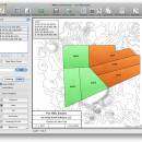
Enter measurements in rods, chains, meters, yards, inches, fathoms, hands, spans or furlongs. Angles can be given down to minutes and seconds. Can auto-close a plot drawing if the final plot segment is missing. Calculate area. Custom labels and backgrounds. Split single plots into multiple plots. GPS Waypoints and more. ...
| Author | Sandy Knoll Software |
| License | Demo |
| Price | FREE |
| Released | 2024-12-04 |
| Downloads | 1002 |
| Filesize | 35.50 MB |
| Requirements | |
| Installation | Instal And Uninstall |
| Keywords | plot map, calculate square feet, calculate acreage, calculator, acreage, perimeter |
| Users' rating (30 rating) |
Using Metes and Bounds Free Download crack, warez, password, serial numbers, torrent, keygen, registration codes,
key generators is illegal and your business could subject you to lawsuits and leave your operating systems without patches.
We do not host any torrent files or links of Metes and Bounds on rapidshare.com, depositfiles.com, megaupload.com etc.
All Metes and Bounds download links are direct Metes and Bounds full download from publisher site or their selected mirrors.
Avoid: survey oem software, old version, warez, serial, torrent, Metes and Bounds keygen, crack.
Consider: Metes and Bounds full version, survey full download, premium download, licensed copy.


