- Software
- - Graphic Apps
- - CAD
- - ProfLT
ProfLT 16.0
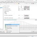
... based on the codes or on the 3D model the program generates longitudinal or cross profiles. The configuration options allow the user customization of the profile templates and saving of new templates, so all users can personalize the program depending on the their requirements. ...
| Author | CADWARE Engineering |
| License | Trialware |
| Price | $300.00 |
| Released | 2023-10-16 |
| Downloads | 298 |
| Filesize | 13.20 MB |
| Requirements | |
| Installation | Instal And Uninstall |
| Keywords | AutoCAD tool, draw longitudinal profile, cross profiles, AutoCAD, Draw, Profile |
| Users' rating (11 rating) |
Using ProfLT Free Download crack, warez, password, serial numbers, torrent, keygen, registration codes,
key generators is illegal and your business could subject you to lawsuits and leave your operating systems without patches.
We do not host any torrent files or links of ProfLT on rapidshare.com, depositfiles.com, megaupload.com etc.
All ProfLT download links are direct ProfLT full download from publisher site or their selected mirrors.
Avoid: terrain model oem software, old version, warez, serial, torrent, ProfLT keygen, crack.
Consider: ProfLT full version, terrain model full download, premium download, licensed copy.


