TOPOWIN 23.02

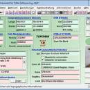
TOPOWIN is a state-wide register of the German topographic cartographies and of localities with geo references in different coordinate systems. It also is a topographic information system. The topographical maps of different standards can be determined by the entering of known parameters or by the direct selection from overview graphics and from sorted lists. ...

Author Killet GeoSoftware Ing.-GbR
License Free To Try
Price $125.00
Released 2024-03-06
Downloads 232
Filesize 4.54 MB
Requirements Pentium, 50 MB HD
Installation Install and Uninstall
Keywords topography, geodetics, geography, corner, box, coordinate, map, guide, TK25, TK50, TK50, TK100, TKUE200, GK5, DGK5, geosoftware, registers, place, topowin, topo, placelist, information, system, measuring
Users' rating
(15 rating)
TOPOWINDatabases & ToolsWin2000, Windows XP, Windows 7 x32, Windows 7 x64, Windows 8, Windows 10, WinServer, WinOther, Windows 2000, Windows 2003, Windows Server 2000, Windows Server 2003, Windows Server 2008, Windows Server 2008r2, Windows Server 2012, Windows Tablet PC Edition 2005, Windows Media Center Editi
TOPOWIN transformations - Download Notice

Using TOPOWIN Free Download crack, warez, password, serial numbers, torrent, keygen, registration codes, key generators is illegal and your business could subject you to lawsuits and leave your operating systems without patches. We do not host any torrent files or links of TOPOWIN on rapidshare.com, depositfiles.com, megaupload.com etc. All TOPOWIN download links are direct TOPOWIN full download from publisher site or their selected mirrors.
Avoid: transformations oem software, old version, warez, serial, torrent, TOPOWIN keygen, crack.
Consider: TOPOWIN full version, transformations full download, premium download, licensed copy.

TOPOWIN transformations - The Latest User Reviews

Most popular Databases & Tools downloads

Dataedo

24.3.2 download

... provides a visual representation of data flow and transformations, helping users trace the origin and movement of data across the organization. This is crucial for ensuring data quality, compliance, and ...

Exportizer Enterprise

9.4.0.321 download

... can apply filters, sort data, and perform complex transformations during the export process. This ensures that the exported data meets specific requirements and is ready for immediate use in other ...

New Version

Altova MapForce Enterprise Edition

v2025 download

... instantly view and save the output. Automate data transformations through the API or ActiveX control. Upload mappings to FlowForce Server for workflow automation. MapForce supports all major databases, including SQL ...

New Version

TOPOWIN

20.01 download

... in suitable graphic views. It accomplishes different coordinate transformations and inquiries. The program was developed under co-operation of the land surveying authorities of many German Federal States. For the first ...

TOPOWIN

23.02 download

... in suitable graphic views. It accomplishes different coordinate transformations and inquiries. The program was developed under co-operation of the land surveying authorities of many German Federal States. For the first ...

Advanced ETL Processor Standard

3.9.9.18 download

... to perform simple data conversions or complex multi-step transformations, this tool has you covered. Another key ... are dealing with large datasets or complex data transformations, this software provides the tools and performance needed ...

Altova MapForce Professional Edition

v2024r2sp1 download

... save the output. You can also automate data transformations through the API or ActiveX control, or upload mappings to FlowForce Server for workflow automation. MapForce supports all major databases, including ...

ETL-Tools QlikView Connector

3.4.5.0 download

... the only one which can perform complex data transformations and validations while loading data into QlikVew. It has more than 500 functions and can load the data from Flat files, ...

SymmetricDS

3.15.8 download

... Users can define specific synchronization rules, filters, and transformations to ensure that only the relevant data is replicated. This level of control helps to optimize performance and reduce unnecessary data ...

TOPOWIN

23.02 download

... in suitable graphic views. It accomplishes different coordinate transformations and inquiries. The program was developed under co-operation of the land surveying authorities of many German Federal States. For the first ...