TriSpace 2021.24.3.652

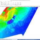
TriSpace is a comprehensive application designed to provide users with a simple means of calculating and viewing terrains.
TriSpace is worth having especially in geological fields due to the extreme facility in creating longitudinal sections.
The aforementioned application also provides you with standard graphic objects such as polygons, arches and rectangles that allow you to indicate perimeters or excluded areas. ...

Author GEOSTRU
License Trialware
Price $500.00
Released 2021-01-21
Downloads 236
Filesize 15.30 MB
Requirements
Installation Instal And Uninstall
Keywords Terrain Calculation, 3D Terrain Viewer, View 3D Surface, Calculation, Terrain, Surface
Users' rating
(5 rating)
TriSpaceCADWindows XP, Windows Vista, Windows Vista x64, Windows 7, Windows 7 x64, Windows 8, Windows 8 x64, Windows 10, Windows 10 x64
TriSpace triangulation - Download Notice

Using TriSpace Free Download crack, warez, password, serial numbers, torrent, keygen, registration codes, key generators is illegal and your business could subject you to lawsuits and leave your operating systems without patches. We do not host any torrent files or links of TriSpace on rapidshare.com, depositfiles.com, megaupload.com etc. All TriSpace download links are direct TriSpace full download from publisher site or their selected mirrors.
Avoid: triangulation oem software, old version, warez, serial, torrent, TriSpace keygen, crack.
Consider: TriSpace full version, triangulation full download, premium download, licensed copy.

TriSpace triangulation - The Latest User Reviews

Most popular CAD downloads

RTOPO Hydrology

3.4Half download

... inexpensive CAD software for surveying. You can do triangulation, isolines, color-filled contour maps, sections, intersections, volume and ... -the projection of several PLine entities over a triangulation -simulation of rainwater runoff; identifies the watershed, the ...

TriSpace

2021.24.3.652 download

... one as it imposes no limits regarding either triangulation points nor on the number of sections. Further thanks to its integration into geotechnic and geological GeoStru programs it allows the ...

TNTmips

20240404 download

... information. Fast and efficient Surface Fitting, Contouring, and Triangulation operations produce Digital Elevation Model rasters (DEMs), contour lines, and triangulated irregular networks (TINs), respectively ... ...

Topography in AutoCAD

2.3 download

... add-on for AUTOCAD or BricsCAD, which makes the triangulation of a set of POINT entities, the intersection ... according to a modifiable library of codes. The triangulation is performed on a convex hull of a ...

TRIANGULATION for IntelliCAD

3.9d download

TRIANGULATION, ISOLINES, VOLUME, LOADING of XYZ points files, 3DINTERSECTION, ... IntelliCAD versions which can load SDS applications (dll). TRIANGULATION performs the triangulation of a set of 3D points with compulsory ... entities. You can make the projection over a triangulation of a 2D POLYLINE and generate cross sections ...

RTOPO LT

3.3 download

... for: loading and drawing XYZ files of points, triangulation, contour lines and color-filled contour maps. You can ... of rainwater runoff, projection of a curve on triangulation, calculation of the volume between surfaces formed by ...

AutoLisp Source

1.1 download

AutoLISP source code can be run on AutoCAD or IntelliCAD (Bricscad, ProgeCAD, Cadopia, etc.), on any number of computers. There are 6 programs for: - "Triangulation" will generate triangular 3DFACE entities, ...

TrueSpace

7.61 download

... geometry after booleans or imports; tools to optimise triangulation or quadrifying polygons to ensure a workable mesh; new point edit selection tools to grow, shrink, invert, and convert a selection; ...

TRIANGULATION for AutoCAD

2.3 download

... add-on for AUTOCAD or BricsCAD, which makes the triangulation of a set of POINT entities, the intersection ... according to a modifiable library of codes. The triangulation is performed on a convex hull of a ...

TriSpace

2021.24.3.652 download

... one as it imposes no limits regarding either triangulation points nor on the number of sections. Further thanks to its integration into geotechnic and geological GeoStru programs it allows the ...