BimRoad Plus

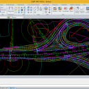
Parametric road design. The world's first software for automatic interchange design. Three-dimensional alignment design. Real-time ... design standards by changing the main alignment. All type of interchange design using user defined connection road. Automatic connection road plan by editing nose point. Automatic correction of road plan design element using parametric method. ...

Author HaneeSoft
License Freeware
Price FREE
Released 2015-01-01
Downloads 96
Filesize 232.65 MB
Requirements At least DirectX 9.0c
Installation Install and Uninstall
Keywords Road design, Interchange design, Alignment, Earthwork
Users' rating
(3 rating)
BimRoadCADWin2000, Windows XP, Windows 7 x32, Windows 7 x64, Windows 8, Windows 10, WinServer, WinOther, Windows Vista, Windows Vista x64
BimRoad type software - Download Notice

Using BimRoad Free Download crack, warez, password, serial numbers, torrent, keygen, registration codes, key generators is illegal and your business could subject you to lawsuits and leave your operating systems without patches. We do not host any torrent files or links of BimRoad on rapidshare.com, depositfiles.com, megaupload.com etc. All BimRoad download links are direct BimRoad full download from publisher site or their selected mirrors.
Avoid: type software oem software, old version, warez, serial, torrent, BimRoad keygen, crack.
Consider: BimRoad full version, type software full download, premium download, licensed copy.

BimRoad type software - The Latest User Reviews

Most popular CAD downloads

VEGA ZZ

3.2.3.28 download

... to make your research jobs very easy. This software is FREE for non-profit academic uses. Extreme ... tool. Atom labels (atom name, element, atom type, atom number, atomic charge, chirality, fixing value, residue, ...

GGCad

2.1.0.5 download

GGCad is a software for g-code ( or iso ) generation. It ... be user friendly. Its simplicity, compared to other software, renders it indispensable. You will control it fastly ... that you can find in most of industrial softwares. You will thus be able to draw different ...

Euler Math Toolbox

2024-01-14 download

The Euler Mathematical Toolbox is a software written and maintained by R. Grothmann, associate professor ... environment to investigate mathematics. Powerful, versatile, mature software for numerical and for symbolic computations including an ...

OpalCalc

1.94 download

OpalCalc is a brand new type of calculator for the PC. As easy to ... Featuring a lightweight footprint, on-the-fly calculation as you type, percentages, variable support, hundreds of units and functions, ...

Automesher 64-bit

2.4.8 download

Automesher x64 application extends AutoCAD and BricsCAD software with functionality to import and export 3D file formats and convert 3D drawing entity types. It supports many of 3D file extensions, including ...

OpalCalc Portable

1.94 download

OpalCalc is a brand new type of calculator for the PC. As easy to ... Featuring a lightweight footprint, on-the-fly calculation as you type, percentages, variable support, hundreds of units and functions, ...

CrystalMaker

11.1.0 download

... CrystalMaker provides a wide range of model types, including traditional "ball-and-stick", space-filling, polyhedral, wireframe and thermal ellipsoids. Each model type can be extensively customized, with the option of ...

CrystalMaker for Mac OS X

11.1.0 download

... CrystalMaker provides a wide range of model types, including traditional "ball-and-stick", space-filling, polyhedral, wireframe and thermal ellipsoids. Each model type can be extensively customized, with the option of ...

TNTmips

20240404 download

TNTmips software is a complete Geographic Information System (GIS) that lets you work with virtually any type of geospatial data including imagery, terrain surfaces, and ... view, create, edit, georeference, interpret, and publish any type of geospatial data. TNTmips provides professional geospatial tools ...

TNTmips for Mac OS X

20240111 download

... (GIS) that lets you work with virtually any type of geospatial data including imagery, terrain surfaces, and ... view, create, edit, georeference, interpret, and publish any type of geospatial data. TNTmips provides professional geospatial tools ...