SimplyCam 3.66

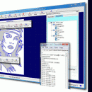
... in industry standard DXF format. Also convert raster images (Bmp and Jpeg) to vector. Generate the contour/engraving, drill and pocket toolpaths for Cnc machines. Import NC programs and simulate it. Included great number of open post-processor such as: AutoGrav, Fanuc, Fadal, Haas, Heidehain, Iso, Mach2/3, MaxNc, Siemens, ShopBot, Tecno-Isel, TurboCnc.. ...

Author MR Soft
License Free To Try
Price $70.00
Released 2020-01-24
Downloads 1578
Filesize 1.63 MB
Requirements Pentium/Amd >300 MHz, True color Video Card (24-bit) - 800 x 600
Installation Install and Uninstall
Keywords cnc, r2v, photo, engraving, bmp, hobby, carving, mill, cad, cam, stl, image, dxf, svg, raster, grayscale, conversion, g-code
Users' rating
(40 rating)
SimplyCamCADWin2000, Windows 7 x32, Windows Vista, Windows XP
SimplyCam vector image - Download Notice

Using SimplyCam Free Download crack, warez, password, serial numbers, torrent, keygen, registration codes, key generators is illegal and your business could subject you to lawsuits and leave your operating systems without patches. We do not host any torrent files or links of SimplyCam on rapidshare.com, depositfiles.com, megaupload.com etc. All SimplyCam download links are direct SimplyCam full download from publisher site or their selected mirrors.
Avoid: vector image oem software, old version, warez, serial, torrent, SimplyCam keygen, crack.
Consider: SimplyCam full version, vector image full download, premium download, licensed copy.

SimplyCam vector image - The Latest User Reviews

Most popular CAD downloads

ChemDoodle

9.1.0 download

... accept ChemDoodle's ICL format or any of the vector image formats provided, just save your document as a ... All mutually inclusive objects, including shapes and images, can be saved with almost all properties preserved. ...

R2V

3.66 download

R2V is a tool for converting raster images to vector by drawing centerlines and outlines. R2V converts architect, ... drawings, maps and other types from raster to vector format. A vector format can be imported into ...

TinyCAD

3.00.04 download

... Turn your circuit diagrams in to PNG images Although you might want to put the ... Instead of being pasted as a bitmap, the image is pasted as a vector graphic, making it ...

ChemDoodle for Linux

9.1.0 download

... accept ChemDoodle's ICL format or any of the vector image formats provided, just save your document as a ... All mutually inclusive objects, including shapes and images, can be saved with almost all properties preserved. ...

Easy CAD Viewer

3.3 download

... viewer; it converts DWG, DXF, DWF drawings to image formats such as BMP, JPG, GIF, PNG, TIFF, ... other formats among DXF, DWG, DWF ยท Create vector-based and full-text searchable PDF and SVG files direct ...

VEGA ZZ

3.2.3.28 download

... PDBQT multi-model formats. Snapshot, hardware and software image rendering with the capability to create images bigger than the monitor size. The software rendering ... PNG, PNM, RAW, SGI, TGA and TIFF. Vector graphic rendering engine. It's possible to export the ...

VeryUtils DWG to SVG Converter Command Line

2.7 download

... AutoCAD, it converts DWG and DXF files into vector SVG files, quick and easily. DWG to SVG ... Converts SHX, TTF font, Xref and embedded raster image/Excel in the DWG/DXF to SVG. * Supports paper ...

SimplyCam

3.66 download

... industry standard DXF format. SimplyCam also convert raster images (Bmp and Jpeg) to vector by drawing centerlines and outlines. SimplyCam allows to manipulate vector (Scale, Rotate, Mirror, Move, Offset), to create cad ...

ChemDoodle for Mac OS X

9.1.0 download

... accept ChemDoodle's ICL format or any of the vector image formats provided, just save your document as a ... All mutually inclusive objects, including shapes and images, can be saved with almost all properties preserved. ...

TNTmips

20240404 download

... with virtually any type of geospatial data including imagery, terrain surfaces, and map data with associated database ... without importing. Overlay your geodata on Bing Maps imagery and maps or on geodata layers published on ...