ArcReader 10.5.0 B6491

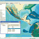
... easy-to-use desktop mapping application that allows users to view, explore, and print maps and globes. ArcReader is ... free and easy-to-use application that allows users to view and print maps that are published as Published Map Files (PMF) by the ArcGIS Publisher extension to ArcView, ArcEditor, and ArcInfo. ...

Author ESRI
License Freeware
Price FREE
Released 2017-02-02
Downloads 248
Filesize 444.00 MB
Requirements
Installation Instal And Uninstall
Keywords view map, print PMF map, export bitmap, view, viewer, map, print
Users' rating
(4 rating)
ArcReaderCADWindows XP, Windows Vista, Windows Vista x64, Windows 7, Windows 7 x64, Windows 8, Windows 8 x64
ArcReader view gis - Download Notice

Using ArcReader Free Download crack, warez, password, serial numbers, torrent, keygen, registration codes, key generators is illegal and your business could subject you to lawsuits and leave your operating systems without patches. We do not host any torrent files or links of ArcReader on rapidshare.com, depositfiles.com, megaupload.com etc. All ArcReader download links are direct ArcReader full download from publisher site or their selected mirrors.
Avoid: view gis oem software, old version, warez, serial, torrent, ArcReader keygen, crack.
Consider: ArcReader full version, view gis full download, premium download, licensed copy.

ArcReader view gis - The Latest User Reviews

Most popular CAD downloads

Thuban for Mac OS X

1.0.1-3 download

Thuban is an interactive geographic data viewer (GIS viewer) which features methods to visualize, explore, and analyze ... information. Thuban is an Interactive Geographic Data Viewer with the following features: # Vector Data ...

QGIS for Linux

3.36.1 download

QGIS is a professional GIS application that is built on top of and ... QGIS aims to be an easy to use GIS, providing common functions and features. The initial goal was to provide a GIS data viewer. QGIS has reached that point in ...

QGIS

3.36.1 download

QGIS is a professional GIS application that is built on top of and ... QGIS aims to be an easy to use GIS, providing common functions and features. The initial goal was to provide a GIS data viewer. QGIS has reached that point in ...

TNTmips

20240404 download

... It provides all the tools you need to view, create, edit, georeference, interpret, and publish any type ... Spatial, DGN, TAB, DXF, DWG ... Full-featured GIS that integrates imagery along with geometric data including ...

CARIS Easy View

4.2.13 download

CARIS Easy View is a simple application that enables you to view spatial data imported from numerous types of files. ... layers, change their order and adjust object parameters. View your spatial data using the free CARIS viewer. ...

Thuban for Windows

1.2.2 download

Thuban is an interactive geographic data viewer (GIS viewer) which features methods to visualize, explore, and analyze ... information. Thuban is an Interactive Geographic Data Viewer with the following features: # Vector Data ...

ArcReader

10.5.0 B6491 download

... easy-to-use desktop mapping application that allows users to view, explore, and print maps and globes. Anyone with ArcReader can view high-quality interactive maps authored by a high-level ArcGIS ... multiple layers supported by PMF documents can be viewed up close using the zooming functions of ArcReader. ...

Thuban for Linux

1.2.2 download

Thuban is an interactive geographic data viewer (GIS viewer) which features methods to visualize, explore, and analyze ... information. Thuban is an Interactive Geographic Data Viewer with the following features: # Vector Data ...

MapInfo Professional

17.0.4 download

MapInfo Professional is a full-featured computer mapping and GIS analysis utility that provides a rich set of ... You can handle data records directly in map view, in a graph or in table view. The ...

QGIS for Mac

3.36.1 download

QGIS is a professional GIS application that is built on top of and ... QGIS aims to be an easy to use GIS, providing common functions and features. The initial goal was to provide a GIS data viewer. QGIS has reached that point in ...